Burrton, Kansas
Burrton is a city in Harvey County, Kansas, United States.[1] It is named after Isaac T. Burr, who is the former vice-president of the Atchison, Topeka and Santa Fe Railway.[4][5] In 2020, 861 people lived there.[3]
Burrton, Kansas | |
|---|---|
 Location within Harvey County and Kansas | |
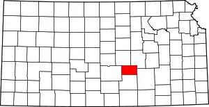
 KDOT map of Harvey County (legend) | |
| Coordinates: 38°01′25″N 97°40′17″W[1] | |
| Country | United States |
| State | Kansas |
| County | Harvey |
| Township | Burrton |
| Platted | 1873 |
| Incorporated | 1878 |
| Named for | Isaac T. Burr |
| Government | |
| • Type | Mayor–Council |
| Area | |
| • Total | 0.89 sq mi (2.30 km2) |
| • Land | 0.89 sq mi (2.30 km2) |
| • Water | 0.00 sq mi (0.00 km2) |
| Elevation | 1,453 ft (443 m) |
| Population | |
| • Total | 861 |
| • Density | 970/sq mi (370/km2) |
| Time zone | UTC-6 (CST) |
| • Summer (DST) | UTC-5 (CDT) |
| ZIP code | 67020 |
| Area code | 620 |
| FIPS code | 20-09575 |
| GNIS ID | 2393474[1] |
| Website | burrtonkansas.com |
History

Burrton was planned out in 1873.[6] It was named after Burrton Township, which was named after I.T. Burr, a railroad official.[7] The first post office in Burrton was created in June 1873.[8] Burrton was incorporated as a city in 1878.[9]
Burrton's place at the junction of two railroads made it an important shipping place for the area.[10]
Geography
Burrton is at 38°1′25″N 97°40′17″W (38.023719, -97.671452).[1] The United States Census Bureau says that the city has a total area of 0.89 square miles (2.31 km2). All of it is land.[2]
People
| Historical population | |||
|---|---|---|---|
| Census | Pop. | %± | |
| 1880 | 386 | — | |
| 1890 | 695 | 80.1% | |
| 1900 | 627 | −9.8% | |
| 1910 | 689 | 9.9% | |
| 1920 | 679 | −1.5% | |
| 1930 | 649 | −4.4% | |
| 1940 | 842 | 29.7% | |
| 1950 | 749 | −11.0% | |
| 1960 | 774 | 3.3% | |
| 1970 | 808 | 4.4% | |
| 1980 | 976 | 20.8% | |
| 1990 | 866 | −11.3% | |
| 2000 | 932 | 7.6% | |
| 2010 | 901 | −3.3% | |
| 2020 | 861 | −4.4% | |
| U.S. Decennial Census | |||
2020 census
The 2020 census says that there were 861 people, 326 households, and 225 families living in Burrton. Of the households, 75.8% owned their home and 24.2% rented their home.
The median age was 37.0 years. Of the people, 86.9% were White, 1.3% were Black, 0.5% were Native American, 0.5% were Asian, 1.7% were from some other race, and 9.2% were two or more races. Hispanic or Latino of any race were 6.4% of the people.[3][11]
Famous people
- Andy Dirks, professional baseball player for the Detroit Tigers.
- Milburn Stone, portrayed fictional Galen "Doc" Adams, M.D., of Dodge City on the long-running CBS western television series, Gunsmoke.
References
- U.S. Geological Survey Geographic Names Information System: Burrton, Kansas
- "2020 U.S. Gazetteer Files". United States Census Bureau. Retrieved November 17, 2023.
- "DP1: PROFILE OF GENERAL POPULATION AND HOUSING CHARACTERISTICS". United States Census Bureau. Retrieved November 17, 2023.
- The Homesteader; Volume 2 Issue 1; January 2006; ISSN 1559-3592
- The Atchison, Topeka, and Santa Fe Railway and Auxiliary Companies - Annual Meetings, and Directors and Officers; January 1, 1902
- History of the State of Kansas: Containing a Full Account of Its Growth from an Uninhabited Territory to a Wealthy and Important State. A. T. Andreas. 1883. p. 786.
- Kansas State Historical Society (1916). Biennial Report of the Board of Directors of the Kansas State Historical Society. Kansas State Printing Plant. p. 204.
- "Kansas Post Offices, 1828-1961 (archived)". Kansas Historical Society. Archived from the original on October 9, 2013. Retrieved 11 June 2014.
- History of the State of Kansas: Containing a Full Account of Its Growth from an Uninhabited Territory to a Wealthy and Important State. A. T. Andreas. 1883. p. 787.
- Blackmar, Frank Wilson (1912). Kansas: A Cyclopedia of State History, Embracing Events, Institutions, Industries, Counties, Cities, Towns, Prominent Persons, Etc. Standard Publishing Company. p. 259. ISBN 9780722249055.
- "P16: HOUSEHOLD TYPE". United States Census Bureau. Retrieved December 30, 2023.
- "American FactFinder". United States Census Bureau. Retrieved 2012-07-06.
- "Burrton Public Schools". USD 369. Archived from the original on 11 March 2020. Retrieved 6 January 2017.
- Kansas School District Boundary Map Archived July 21, 2011, at the Wayback Machine
Other websites
- City
- Schools
- USD 369, local school district
- Historical
- Harvey County Genealogical Society
- Harvey County Roots
- Historic Images of Burrton, Special Photo Collections at Wichita State University Library
- Maps
- Burrton City Map, KDOT
- Harvey County Maps: Current, Historic, KDOT
Municipalities and communities of Harvey County, Kansas, United States | ||
|---|---|---|
| Cities |
|  Map of Kansas highlighting Harvey County |
| Townships |
| |
| Unincorporated communities |
| |
| Ghost town |
| |
| Footnotes | ‡This populated place also has portions in an adjacent county or counties | |