Anderson County, Texas
Anderson County is a county in the U.S. state of Texas. In 2020, 57,922 people lived there.[1] The county seat is Palestine.
Anderson County | |
|---|---|
.jpg.webp) The Anderson County Courthouse in Palestine | |
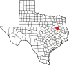 Location within the U.S. state of Texas | |
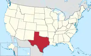 Texas's location within the U.S. | |
| Coordinates: 31°49′N 95°39′W | |
| Country | |
| State | |
| Founded | March 24, 1846 |
| Named for | Kenneth L. Anderson |
| Seat | Palestine |
| Largest city | Palestine |
| Area | |
| • Total | 1,078 sq mi (2,790 km2) |
| • Land | 1,063 sq mi (2,750 km2) |
| • Water | 15 sq mi (40 km2) 1.4% |
| Population | |
| • Total | 57,922 |
| • Density | 54/sq mi (21/km2) |
| Time zone | UTC−6 (Central) |
| • Summer (DST) | UTC−5 (CDT) |
| Website | www |
History
The county was made in 1846.
Geography
The county has a total area of 1,078 square miles.
Places
City
- Palestine (county seat)
Other
- Alderbranch
- Bethel
- Blackfoot
- Bois d'Arc
- Bradford
- Brushy Creek
- Cayuga
- Cronin
- Crystal Lake
- Deanwright
- Elmtown
- Elmwood
- Fosterville
- Greens Bluff
- Long Lake
- Montalba
- Mound City
- Neches
- Pert
- Salmon
- Slocum
- Tennessee Colony
References
- "Anderson County, Texas". United States Census Bureau. Retrieved August 5, 2023.
Places next to Anderson County, Texas | ||||||||||
|---|---|---|---|---|---|---|---|---|---|---|
| ||||||||||
Municipalities and communities of Anderson County, Texas, United States | ||
|---|---|---|
| City | Anderson County map | |
| Towns | ||
| CDP |
| |
| Other communities |
| |
| Ghost towns |
| |
| Footnote | ‡This populated place also has portions in an adjacent county or counties | |
This article is issued from Wikipedia. The text is licensed under Creative Commons - Attribution - Sharealike. Additional terms may apply for the media files.