Abra (province)
Abra (Ilocano: Probinsia ti Abra; Tagalog: Lalawigan ng Abra) is province of the Philippines in the Cordillera Administrative Region in Luzon. The capital is Bangued, and is bordered by Ilocos Norte on the northwest, Apayao on the northeast, Kalinga on the mid-east, Mountain Province on the southeast, and Ilocos Sur on the southwest.
Abra | |
|---|---|
| Province of Abra | |
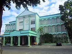
 Abra Provincial Capitol | |
 Flag  Seal | |
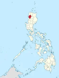
 Location in the Philippines | |
| Coordinates: 17°35′N 120°45′E | |
| Region | Cordillera Administrative Region (CAR) |
| Founded | 10 March 1917 |
| Capital | Bangued |
| Government | |
| • Type | Sangguniang Panlalawigan |
| • Governor | Maria Jocelyn Acosta Valera-Bernos (NUP/Hugpong ng Pagbabago) |
| • Vice Governor | Ronald Stimson Balao-as (NUP) |
| Area | |
| • Total | 4,165.25 km2 (1,608.21 sq mi) |
| • Rank | 29th out of 81 |
| Highest elevation (Mount Bangbanglang) | 2,454 m (8,051 ft) |
| Population (2020 census) | |
| • Total | 250,985 |
| • Rank | 68th out of 81 |
| • Density | 60/km2 (160/sq mi) |
| • Rank | 80th out of 81 |
| Divisions | |
| • Independent cities | 0 |
| • Component cities | 0 |
| • Municipalities | |
| • Barangays | 303 |
| • Districts | Lone District of Abra |
| Time zone | UTC+8 (PHT) |
| ZIP code | 2800–2826 |
| IDD : area code | +63 (0)74 |
| ISO 3166 code | PH-ABR |
| Spoken languages | |
| Website | www |
References
- "List of Provinces". PSGC Interactive. Makati City, Philippines: National Statistical Coordination Board. Archived from the original on 11 January 2013. Retrieved 30 December 2013.
This article is issued from Wikipedia. The text is licensed under Creative Commons - Attribution - Sharealike. Additional terms may apply for the media files.