A10 road (England)
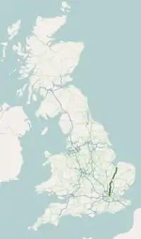
The A10 is an important road in eastern England. It goes between London and King's Lynn. It follows the old route of the Roman road Ermine Street for much of its route. The road is about 90 miles (140 km) long in total.[1]
 | |
|---|---|
 | |
| Route information | |
| Length | 90.41 mi (145.50 km) |
| Major junctions | |
| South end | London Bridge51.5079°N 0.0872°W |
A104 A107 A109 A120 A14 A47 | |
| North end | King's Lynn52.754°N 0.398°E |
| Location | |
| Country | United Kingdom |
| Primary destinations | Southwark Enfield Hertford Buntingford Royston Cambridge Ely |
| Road network | |
| |
References
- "Relation: A10 Road (Great Britain) (5727226)". OpenStreetMap. 17 November 2019. Archived from the original on 19 June 2022. Retrieved 6 January 2020.
A roads in Zone 1 of the Great Britain road numbering scheme | ||
|---|---|---|
| ||
| ||
| ||
This article is issued from Wikipedia. The text is licensed under Creative Commons - Attribution - Sharealike. Additional terms may apply for the media files.