| Zherebets River | |
|---|---|
 | |
| Location | |
| Country | |
| Oblast | |
| Physical characteristics | |
| Source | |
| • location | Stelmakhivka |
| • coordinates | 49°30′14″N 37°54′35″E / 49.50389°N 37.90972°E |
| Mouth | |
• location | Siverskyi Donets |
• coordinates | 48°56′22″N 38°03′09″E / 48.93944°N 38.05250°E |
| Length | 88 kilometres (55 mi) |
| Basin size | 990 km2 (382.24 sq mi) |
| Discharge | |
| • average | 25.37 m3/s (896 cu ft/s) |
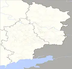
The Zherebets (Ukrainian: Жеребець) is a river in eastern Ukraine. It is a tributary of the Donets, and mainly flows through the western areas of the Donbas, including Svatove Raion, Sievierodonetsk Raion, and Kramatorsk Raion. The length of the river is approximately 88 km, and the floodplain is almost 1,000 km2 in area.[1][2]
References
- ↑ Psaropoulos, John. "New wave of Russian air raids hits Ukrainian cities, energy sites". www.aljazeera.com. Retrieved 2022-10-24.
- ↑ Europe, Council of (1996-01-01). Seminar on the Biology and the Conservation of the European Desmans and Water Shrews (Galemys Pyrenaicus, Desmana Moschata, Neomys Spp.): Ordesa, Spain, 7-11 June 1995. Council of Europe. ISBN 978-92-871-2969-7.
48°56′22″N 38°05′34″E / 48.9395°N 38.0927°E
This article is issued from Wikipedia. The text is licensed under Creative Commons - Attribution - Sharealike. Additional terms may apply for the media files.