Native name: Wilhelmøya | |
|---|---|
 Wilhelm Island in lower left | |
| Geography | |
| Location | Arctic Ocean |
| Coordinates | 79°3′N 20°25′E / 79.050°N 20.417°E |
| Archipelago | Svalbard |
| Area | 120 km2 (46 sq mi) |
| Highest elevation | 566 m (1857 ft) |
| Administration | |
Norway | |
| Demographics | |
| Population | 0 |
Wilhelm Island[1][2][3] (Norwegian: Wilhelmøya) is an island in the Svalbard archipelago. It is situated northeast of Olav V Land on Spitsbergen, in Hinlopen Strait. Its area is 120 km². About 33.5 % of the island is covered with ice. The island was named after Wilhelm I.[4]
See also
References
- ↑ Nikitenko, B. L., & M. B. Mickey. 2004. Foraminifera and Ostracodes across the Pliensbachian-Toarcian Boundary in the Arctic Realm. In: Alwynne Bowyer Beaudoin & Martin J. Head (eds.), The Palynology and Micropalaeontology of Boundaries, pp. 137–174. London: The Geological Society, p. 153.
- ↑ Mills, William James. 2003. Exploring Polar Frontiers: A Historical Encyclopedia. Volume 1: A–L. Santa Barbara, CA: ABC Clio, p. 363.
- ↑ Logan, Alan, & L. V. Hills. 1973. The Permian and Triassic Systems and Their Mutual Boundary. Calgary: Canadian Society of Petroleum Geologists, p. 267.
- ↑ "Wilhelmøya". The Norwegian Polar Institute. Retrieved 29 May 2012.

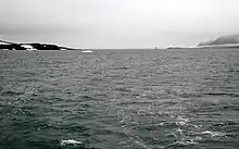
Bjørnsundet, a sound between Olav V Land (left) and Wilhelm Island (right)
This article is issued from Wikipedia. The text is licensed under Creative Commons - Attribution - Sharealike. Additional terms may apply for the media files.