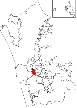
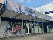
Whau Local Board | |
|---|---|
 Whau in Auckland | |
| Country | New Zealand |
| Region | Auckland |
| Territorial authority | Auckland |
| Ward | Whau ward |
| Legislated | 2010 |
| Government | |
| • Board chair | Kay Thomas (Labour) |
| Area | |
| • Land | 26.82 km2 (10.36 sq mi) |
| Population (June 2023)[2] | |
| • Total | 86,300 |
Local Board Members | |
|---|---|
| Structure | |
5 / 7 | |
Independent | 2 / 7 |
| Elections | |
Last election | 2022 |
Next election | 2025 |
The Whau Local Board is one of the 21 local boards of the Auckland Council. It is the only local board overseen by the council's Whau Ward councillor.
The Whau board, named after the Whau River estuary which runs through the board area, covers the suburbs of Avondale, Blockhouse Bay, Green Bay, Kelston, New Lynn and New Windsor.[3]
The board consists of seven members elected at large. The inaugural members were elected in the nationwide 2010 local elections, coinciding with the introduction of the Auckland Council.
Demographics

Whau Local Board Area covers 26.82 km2 (10.36 sq mi)[1] and had an estimated population of 86,300 as of June 2023,[2] with a population density of 3,218 people per km2.
2022–2025 term
The board's term currently runs from the 2022 local body elections to the local body elections in 2025. The current board members are:[4]
- Kay Thomas (chair)
- Fasitua Amosa (deputy chair)
- Susan Zhu
- Catherine Farmer
- Warren Piper
- Sarah Paterson-Hamlin
- Ross Clow
2019–2022 term
The board's term from the 2019 local body elections to the local body elections in 2022. The board members are:[5]
- Kay Thomas (chair)
- Susan Zhu (deputy chair)
- Catherine Farmer
- Warren Piper
- Fasitua Amosa
- Ulalemamae Te'eva Matafai
- Jessica Rose
References
- 1 2 "ArcGIS Web Application". statsnz.maps.arcgis.com. Retrieved 25 February 2022.
- 1 2 "Subnational population estimates (RC, SA2), by age and sex, at 30 June 1996-2023 (2023 boundaries)". Statistics New Zealand. Retrieved 25 October 2023. (regional councils); "Subnational population estimates (TA, SA2), by age and sex, at 30 June 1996-2023 (2023 boundaries)". Statistics New Zealand. Retrieved 25 October 2023. (territorial authorities); "Subnational population estimates (urban rural), by age and sex, at 30 June 1996-2023 (2023 boundaries)". Statistics New Zealand. Retrieved 25 October 2023. (urban areas)
- ↑ "Whau ward and local board map" (PDF). Retrieved 23 July 2010.
- ↑ "Contact Whau Local Board". Auckland Council. Retrieved 4 November 2022.
- ↑ "Contact Whau Local Board". Auckland Council. Retrieved 22 October 2018.