Wando
완도군 | |
|---|---|
| Korean transcription(s) | |
| • Hangul | 완도군 |
| • Hanja | 莞島郡 |
| • Revised Romanization | Wando-gun |
| • McCune-Reischauer | Wando-gun |
 Flag Emblem of Wando | |
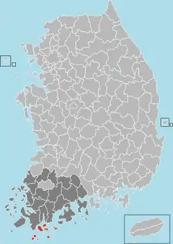 Location in South Korea | |
| Country | |
| Region | Honam |
| Administrative divisions | 3 eup, 9 myeon |
| Area | |
| • Total | 391.81 km2 (151.28 sq mi) |
| Population (2001) | |
| • Total | 66,978 |
| • Density | 179/km2 (460/sq mi) |
| • Dialect | Jeolla |
Wando County (Wando-gun) is a county in South Jeolla Province, South Korea. It takes its name from the island of Wando, which is the largest island within the county and serves as the county seat. Wando island is perhaps most famous for Cheonghaejin, the former headquarters of Jang Bogo, a 9th-century Korean historical figure whose private fleet and army dominated the sea routes in the Yellow Sea. Wando's most famous native in modern times is champion golfer K.J. Choi.

wandogun
Districts
| Classification | Area (km2) | Units | Population |
|---|---|---|---|
| Wando-eup | 54.11 | 8,089 | 19,761 |
| Geumil-eup | 28.14 | 1,945 | 4,033 |
| Nohwa-eup | 31.94 | 2,545 | 5,780 |
| Gunwae-myun | 42.78 | 1,889 | 3,732 |
| Shinji-myun | 31.31 | 1,822 | 3,874 |
| Gogeum-myun | 46.38 | 2,263 | 4,651 |
| Yaksan-myun | 28.80 | 1,28 | 2,586 |
| Chungsan-myun | 41.88 | 1,319 | 2,613 |
| Soan-myun | 28.37 | 1,4 | 3,021 |
| Geumdang-myun | 14.22 | 560 | 1,184 |
| Bogil-myun | 32.54 | 1,141 | 2,819 |
| Saengil-myun | 15.07 | 492 | 945 |
| Total | 395.54 | 24,745 | 54,999 |
Speciality
The best Gim is produced in the Wando area. Laver farming goes back 200 years, and with 22%, Wando is the biggest production area. In 2006, Wando exported about 2.3 million tons of green laver to the United States, Japan, and Taiwan.[1]
Climate
| Climate data for Wando (1991–2020 normals, extremes 1971–present) | |||||||||||||
|---|---|---|---|---|---|---|---|---|---|---|---|---|---|
| Month | Jan | Feb | Mar | Apr | May | Jun | Jul | Aug | Sep | Oct | Nov | Dec | Year |
| Record high °C (°F) | 19.5 (67.1) |
20.0 (68.0) |
23.0 (73.4) |
27.6 (81.7) |
31.9 (89.4) |
31.9 (89.4) |
36.2 (97.2) |
36.9 (98.4) |
34.0 (93.2) |
29.9 (85.8) |
24.4 (75.9) |
20.3 (68.5) |
36.9 (98.4) |
| Mean daily maximum °C (°F) | 6.3 (43.3) |
8.3 (46.9) |
12.6 (54.7) |
17.9 (64.2) |
22.5 (72.5) |
25.4 (77.7) |
28.3 (82.9) |
29.8 (85.6) |
26.6 (79.9) |
21.6 (70.9) |
15.2 (59.4) |
8.8 (47.8) |
18.6 (65.5) |
| Daily mean °C (°F) | 2.7 (36.9) |
3.9 (39.0) |
7.8 (46.0) |
12.9 (55.2) |
17.6 (63.7) |
21.2 (70.2) |
24.7 (76.5) |
26.0 (78.8) |
22.3 (72.1) |
16.9 (62.4) |
10.8 (51.4) |
4.9 (40.8) |
14.3 (57.7) |
| Mean daily minimum °C (°F) | −0.4 (31.3) |
0.2 (32.4) |
3.6 (38.5) |
8.5 (47.3) |
13.4 (56.1) |
17.9 (64.2) |
22.1 (71.8) |
23.2 (73.8) |
19.0 (66.2) |
13.0 (55.4) |
7.0 (44.6) |
1.4 (34.5) |
10.7 (51.3) |
| Record low °C (°F) | −10.2 (13.6) |
−10.7 (12.7) |
−6.9 (19.6) |
−0.9 (30.4) |
5.1 (41.2) |
9.9 (49.8) |
16.5 (61.7) |
13.9 (57.0) |
11.0 (51.8) |
2.1 (35.8) |
−2.9 (26.8) |
−10.2 (13.6) |
−10.7 (12.7) |
| Average precipitation mm (inches) | 34.0 (1.34) |
52.6 (2.07) |
103.7 (4.08) |
141.7 (5.58) |
147.0 (5.79) |
207.2 (8.16) |
257.2 (10.13) |
238.8 (9.40) |
176.4 (6.94) |
73.0 (2.87) |
62.7 (2.47) |
37.2 (1.46) |
1,531.5 (60.30) |
| Average precipitation days (≥ 0.1 mm) | 8.0 | 7.6 | 8.9 | 8.9 | 9.3 | 11.5 | 13.5 | 11.8 | 9.7 | 5.8 | 7.8 | 8.3 | 111.1 |
| Average snowy days | 7.2 | 4.6 | 1.5 | 0.0 | 0.0 | 0.0 | 0.0 | 0.0 | 0.0 | 0.0 | 0.4 | 4.8 | 18.5 |
| Average relative humidity (%) | 65.1 | 64.0 | 64.3 | 65.8 | 70.8 | 79.5 | 85.0 | 82.6 | 77.2 | 69.3 | 68.6 | 66.6 | 71.6 |
| Mean monthly sunshine hours | 149.0 | 161.6 | 189.6 | 203.7 | 214.3 | 162.3 | 150.4 | 175.5 | 167.6 | 206.5 | 162.0 | 149.9 | 2,092.4 |
| Percent possible sunshine | 47.4 | 50.8 | 48.8 | 52.0 | 47.8 | 36.8 | 33.1 | 44.0 | 44.6 | 58.0 | 52.2 | 48.5 | 46.5 |
| Source: Korea Meteorological Administration (snow and percent sunshine 1981–2010)[2][3][4] | |||||||||||||
Twin towns – sister cities
Wando is twinned with:
See also
- Sinjido
- Saengildo
- Cheongsando - Cheongsando(Cheongsan island) is designated as a slow city.
References
- ↑ "'김의 고장' 완도서 햇김 본격 출하". Newsis. Retrieved 2007-11-08.
- ↑ "Climatological Normals of Korea (1991 ~ 2020)" (PDF) (in Korean). Korea Meteorological Administration. Archived from the original (PDF) on 29 January 2022. Retrieved 4 April 2022.
- ↑ 순위값 - 구역별조회 (in Korean). Korea Meteorological Administration. Retrieved 4 April 2022.
- ↑ "Climatological Normals of Korea" (PDF). Korea Meteorological Administration. 2011. Archived from the original (PDF) on 7 December 2016. Retrieved 8 December 2016.
External links

This article is issued from Wikipedia. The text is licensed under Creative Commons - Attribution - Sharealike. Additional terms may apply for the media files.