Waldbillig
Waldbëlleg, Bëlleg | |
|---|---|
.jpg.webp) Town hall | |
 Coat of arms | |
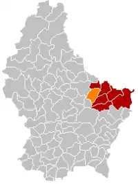 Map of Luxembourg with Waldbillig highlighted in orange, and the canton in dark red | |
| Coordinates: 49°47′45″N 6°17′10″E / 49.7958°N 6.2861°E | |
| Country | |
| Canton | Echternach |
| Area | |
| • Total | 23.28 km2 (8.99 sq mi) |
| • Rank | 40th of 102 |
| Highest elevation | 387 m (1,270 ft) |
| • Rank | 63rd of 102 |
| Lowest elevation | 186 m (610 ft) |
| • Rank | 18th of 102 |
| Population (2023) | |
| • Total | 1,960 |
| • Rank | 82nd of 102 |
| • Density | 84/km2 (220/sq mi) |
| • Rank | 78th of 102 |
| Time zone | UTC+1 (CET) |
| • Summer (DST) | UTC+2 (CEST) |
| LAU 2 | LU0001008 |
| Website | waldbillig.lu |
Waldbillig (Luxembourgish: Waldbëlleg or (locally) Bëlleg [ˈbələɕ]) is a commune and small town in the canton of Echternach, Luxembourg.
As of 2020, the town of Waldbillig, which lies in the centre of the commune, has a population of 566. Other towns within the commune include Christnach with a population of 793 and Haller with a population of 413. Other localities include Mullerthal with 55 inhabitants and Freckeisen with a population of 50.[1]
History
Population
References
- ↑ "Commune de Waldbillig". waldbillig.lu (in French). Retrieved 8 March 2023.
- ↑ "Population par canton et commune". statistiques.public.lu. Retrieved 11 January 2022.
External links
 Media related to Waldbillig at Wikimedia Commons
Places adjacent to Waldbillig | |
|---|---|

This article is issued from Wikipedia. The text is licensed under Creative Commons - Attribution - Sharealike. Additional terms may apply for the media files.