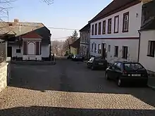
Vacov | |
|---|---|
.JPG.webp) Church of Saint Nicholas | |
 Flag  Coat of arms | |
 Vacov Location in the Czech Republic | |
| Coordinates: 49°8′10″N 13°43′47″E / 49.13611°N 13.72972°E | |
| Country | |
| Region | South Bohemian |
| District | Prachatice |
| First mentioned | 1193 |
| Area | |
| • Total | 35.21 km2 (13.59 sq mi) |
| Elevation | 732 m (2,402 ft) |
| Population (2023-01-01)[1] | |
| • Total | 1,442 |
| • Density | 41/km2 (110/sq mi) |
| Time zone | UTC+1 (CET) |
| • Summer (DST) | UTC+2 (CEST) |
| Postal codes | 384 73, 384 86 |
| Website | www |
Vacov (Czech pronunciation: [ˈvatsof]) is a municipality and village in Prachatice District in the South Bohemian Region of the Czech Republic. It has about 1,400 inhabitants.
Administrative parts

Villages of Benešova Hora, Čábuze, Javorník, Lhota nad Rohanovem, Milíkov, Miřetice, Mladíkov, Nespice, Přečín, Ptákova Lhota, Rohanov, Vlkonice and Žár are administrative parts of Vacov.
Geography
Vacov is located about 23 kilometres (14 mi) northwest of Prachatice and 56 km (35 mi) northwest of České Budějovice. It lies in the Bohemian Forest Foothills. The highest point is the mountain Javorník at 1,066 m (3,497 ft) above sea level.
History
The first written mention of Vacov is from 1193.[2]
Sights
The main landmark is the Church of Saint Nicholas. It was built in the pseudo-Gothic style in 1889–1890, after the old church was demolished. Next to the church there is the Chapel of Saint John of Nepomuk from the 18th century.[2]
Notable people
- Matěj Kopecký (1775–1847), puppeteer; lived in Přečín in 1836–1847
References
- ↑ "Population of Municipalities – 1 January 2023". Czech Statistical Office. 2023-05-23.
- 1 2 "Kostel sv. Mikuláše, Vacov" (in Czech). Obec Vacov. Retrieved 2021-08-23.