| Utica Canal Terminal Harbor | |
|---|---|
 Harbor in 2015 looking north | |
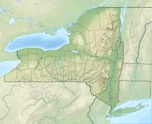 Utica Canal Terminal Harbor  Utica Canal Terminal Harbor | |
| Location | Oneida County, New York |
| Coordinates | 43°06′35″N 75°13′25″W / 43.10972°N 75.22361°W |
| Primary outflows | Mohawk River, Erie Canal |
| Surface elevation | 394 feet (120 m)[1] |
| Settlements | Utica |

The Utica Tower and harbor lock.
Utica Canal Terminal Harbor, commonly known as Utica Harbor, is a small man-made harbor in Utica, Oneida County, New York. The harbor was once connected to the Mohawk River and the Erie Canal by the Utica Harbor Lock, which is now permanently closed and used only for flood control.
References
External links
 Media related to Utica Harbor Lock at Wikimedia Commons
This article is issued from Wikipedia. The text is licensed under Creative Commons - Attribution - Sharealike. Additional terms may apply for the media files.