| Upper Peoria Lake | |
|---|---|
 View of Upper Peoria Lake from the Peoria Heights water tower observation deck | |
 Upper Peoria Lake  Upper Peoria Lake | |
| Location | Peoria / Woodford / Tazewell counties, Illinois, US |
| Coordinates | 40°48′24″N 89°33′4″W / 40.80667°N 89.55111°W |
| Primary inflows | Illinois River |
| Primary outflows | Illinois River |
| Basin countries | United States |
| Surface area | 6,256.7 hectares (15,461 acres) |
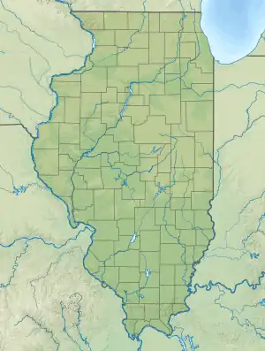
Upper Peoria Lake is a section of the Illinois River primarily between Peoria County and Woodford County, Illinois, United States. The lake runs from South Rome to Peoria Heights, with Spring Bay and the Detweiller Marina area of Peoria near the middle. Just north of Peoria Heights, it empties through a narrow part of the Illinois River into the smaller Peoria Lake, sometimes called Lower Peoria Lake, at approximately river mile 166.5.[1]
Geology
The Upper Peoria Lake originated during the Woodfordian substage of the Wisconsin glaciation.[1][2] It is part of the Bloomington moraine.[2] Upper Peoria Lake is a remnant of old Glacial Lake Illinois, which formed behind the moraine.[2]
Due to the flat stream bed, the water moves slowly, allowing sediment to settle at the bottom.[2]
Restoration
Since 1903, the lake has lost approximately 68% of its original volume and the average depth has been reduced from 8.1 ft (2.5 m) to 2.6 ft (0.79 m).[3] Sedimentation and the soft bottom of the lake are not conducive for aquatic plants, which attract waterfowl.[3]
In July 1990, the Peoria Lake Habitat Rehabilitation and Enhancement Project, a joint project between the U.S. Army Corps of Engineers, U.S. Fish and Wildlife Service, and Illinois Department of Natural Resources, worked on the northernmost end of the Upper Peoria Lake.[3] This project achieved:
- Constructed the Barrier and Overburden Islands and dredged approximately 229,366.457 m3 (8,100,000.0 cu ft) of sediment
- Excavated a channel in the East River to remove a silt plug
- Constructed a rock closure to reduce sediment from the northern boundary with Goose Lake
- Constructed approximately 18,585 ft (5,665 m) of low level levees, 3 water control structures, and a pump station
- Planted select vegetation to enhance the wetland habitat
Fauna
Pollution has been a significant factor in decreasing levels of wildlife.[4][5][6]
Fish
Several species of fish are listed by the Illinois Department of Natural Resources for Upper Peoria Lake.[7]
Species |
Rank |
|---|---|
| Bluegill | Excellent |
| Channel catfish | Excellent |
| Crappie | Good |
| Flathead catfish | Very Good |
| Largemouth bass | Excellent |
| Sauger | Excellent |
| Smallmouth bass | Improving |
| Walleye | Excellent |
Waterfowl
Upper Peoria Lake is a notable wildlife refuge for migrating waterfowl.[8]
Recreation
The lake is currently a regional tourist attraction and is used for practice of many watersports.
Several public lands border the Peoria Lake,[9] including:
- Grand View Park
- Al Fresco Park
- Poplar Lane Park
- Detweiller Park
- Gaylord Wildlife Area
- Robert Rutherford Wildlife Sanctuary
- Woodford State and Fish Wildlife Area
- Spring Bay Park
- Spring Bay Fen Nature Preserve
Other notable landmarks include:
- Peoria Waterworks
- Grandview Drive
- Shore Acres Clubhouse
- Illinois Valley Yacht and Canoe Club
- East Peoria Boat and Recreation
References
- 1 2 US Army Corps of Engineers, Rock Island District (1990-07-01). "Peoria Lake Enhancement" (PDF). Retrieved 2023-10-13.
- 1 2 3 4 Bevenour, Donald E.; Emmons, Kevin M.; Hobbs, Martin (2007). "The Physical Geography of the Illinois River Valley Near Peoria: An Updated Self-Conducted Field Trip using EcoCaches and GPS Technology" (PDF). Retrieved 2023-10-13.
- 1 2 3 "Peoria Lake". ArcGIS StoryMaps. 2023-05-30. Retrieved 2023-10-14.
- ↑ Baker, Frank Collins (1926). Richardson, Robert E. (ed.). "Changes in the Bottom Fauna of the Illinois River Due to Pollutional Causes". Ecology. 7 (2): 229–230. doi:10.2307/1928948. ISSN 0012-9658.
- ↑ Mathis, B. J.; Cummings, T. F. (1973). "Selected Metals in Sediments, Water, and Biota in the Illinois River". Journal (Water Pollution Control Federation). 45 (7): 1573–1583. ISSN 0043-1303.
- ↑ Wisely, W. H.; Klassen, Clarence W. (1938). "The Pollution and Natural Purification of Illinois River below Peoria". Sewage Works Journal. 10 (3): 569–595. ISSN 0096-9362.
- ↑ "Lake Profile --". www.ifishillinois.org. Retrieved 2023-10-08.
- ↑ Bellrose, Frank C. (1954). "The Value of Waterfowl Refuges in Illinois". The Journal of Wildlife Management. 18 (2): 160–169. doi:10.2307/3797710. ISSN 0022-541X.
- ↑ "River Pool -- Illinois - Peoria". www.ifishillinois.org. Retrieved 2023-10-13.