Unity Township | |
|---|---|
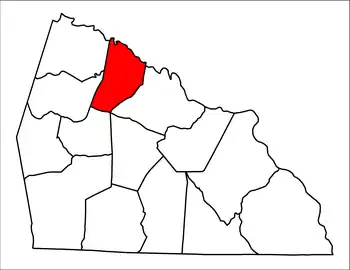
 Location of Unity Township in Rowan County | |
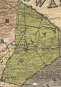
 Unity Township in 1903 | |
| Country | United States |
| State | North Carolina |
| County | Rowan |
| Established in | 1868 |
| Government | |
| • Type | non-functioning county subdivision |
| Time zone | UTC-5 (Eastern (EST)) |
| • Summer (DST) | UTC-4 (EDT) |
Unity Township is one of fourteen townships in Rowan County, North Carolina, United States. The township had a population of 2,215 according to the 2010 census.[1]
Geographically, Unity Township occupies 24.82 square miles (64.3 km2) in northwestern Rowan County. There are no incorporated municipalities in Unity Township. The township's northern boundary is with Davie County.
Residents are served by the Rowan–Salisbury School System.
History
Villages, churches, and schools in Unity Township have included the following:[2][3][4]
- Audubon
- Barber School
- Cooleemee Cotton Mills
- Harrison School
- Hart School
- Lebanon Lutheran Church, formed in 1893[5]
- Unity Presbyterian Church, formed in 1788[6]
- Woodleaf or Wood Leaf until 1877, post office established on 4 September 1855 with Daniel Wood as the first postmaster[7]
- Woodleaf Baptist Church, formed in 1978[8]
- Woodleaf Speedway
- Woodlead United Methodist Church
Adjacent townships
- Calahaln Township, Davie County – northwest
- Cleveland – southwest
- Franklin – east
- Jerusalem Township, Davie County – northeast
- Litaker – southeast
- Mocksville Township, Davie County – north
- Scotch Irish – west
- Steele – south
References
- ↑ "U.S. Census website". United States Census Bureau. Retrieved May 14, 2011.
- ↑ Rowan County GIS system
- ↑ Miller, C.M. (1903). "1903 Map of Rowan County, North Carolina". Rowan County GIS website. Retrieved June 29, 2022.
- ↑ Trexler, NA (1930). "1930 Map of Rowan County, North Carolina". Rowan County GIS website. Retrieved June 29, 2022.
- ↑ "History of Lebanon Lutheran Church". Lebanon Lutheran Church. Retrieved October 2, 2022.
- ↑ To dwell together in unity : Unity Presbyterian Church, Woodleaf, North Carolina, the first two hundred years, 1788-1988. Unity Presbyterian Church. 1988.
- ↑ Lewis, J.D. "Rowan County Post Offices". Retrieved October 2, 2022.
- ↑ "History of Woodleaf Baptist Church". Woodleaf Baptist Church. Retrieved October 2, 2022.
35°46′25″N 80°34′38″W / 35.7737251°N 80.5771737°W
This article is issued from Wikipedia. The text is licensed under Creative Commons - Attribution - Sharealike. Additional terms may apply for the media files.
