Uchaud
| |
|---|---|
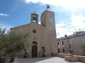 The church in Uchaud | |
.svg.png.webp) Coat of arms | |
Location of Uchaud | |
 Uchaud 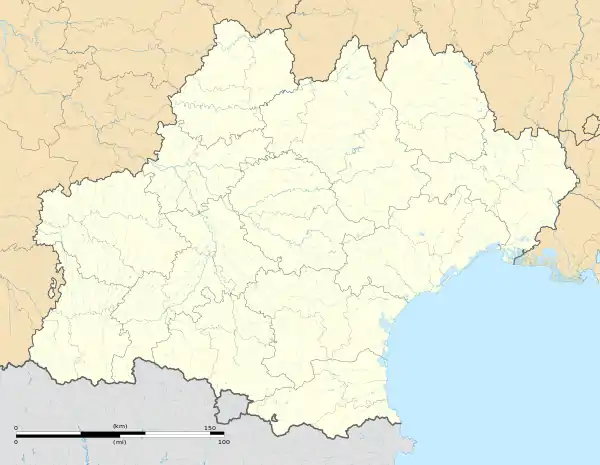 Uchaud | |
| Coordinates: 43°45′28″N 4°16′12″E / 43.7578°N 4.27°E | |
| Country | France |
| Region | Occitania |
| Department | Gard |
| Arrondissement | Nîmes |
| Canton | Vauvert |
| Intercommunality | CC Rhôny Vistre Vidourle |
| Government | |
| • Mayor (2020–2026) | Joffrey Léon[1] |
| Area 1 | 8.8 km2 (3.4 sq mi) |
| Population | 4,761 |
| • Density | 540/km2 (1,400/sq mi) |
| Demonym | Uchaudois |
| Time zone | UTC+01:00 (CET) |
| • Summer (DST) | UTC+02:00 (CEST) |
| INSEE/Postal code | 30333 /30620 |
| Elevation | 15–102 m (49–335 ft) (avg. 24 m or 79 ft) |
| Website | www.uchaud.fr |
| 1 French Land Register data, which excludes lakes, ponds, glaciers > 1 km2 (0.386 sq mi or 247 acres) and river estuaries. | |
Uchaud (French pronunciation: [yʃo]; Occitan: Uchau) is a commune in the Gard department in the Occitania region in Southern France. In 2020, it had a population of 4,542.
Transport
Uchaud station has rail connections to Nîmes, Avignon and Montpellier.
Demographics
| Year | Pop. | ±% p.a. |
|---|---|---|
| 1968 | 1,378 | — |
| 1975 | 1,904 | +4.73% |
| 1982 | 2,339 | +2.98% |
| 1990 | 2,699 | +1.81% |
| 1999 | 3,284 | +2.20% |
| 2007 | 3,873 | +2.08% |
| 2012 | 4,203 | +1.65% |
| 2017 | 4,315 | +0.53% |
| Source: INSEE[3] | ||
See also
References
- ↑ "Répertoire national des élus: les maires" (in French). data.gouv.fr, Plateforme ouverte des données publiques françaises. 13 September 2022.
- ↑ "Populations légales 2021". The National Institute of Statistics and Economic Studies. 28 December 2023.
- ↑ Population en historique depuis 1968, INSEE.
Wikimedia Commons has media related to Uchaud.
This article is issued from Wikipedia. The text is licensed under Creative Commons - Attribution - Sharealike. Additional terms may apply for the media files.