Tulsipur | |
|---|---|
Town | |
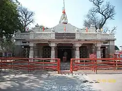 Devi Patan Temple at Tulsipur India | |
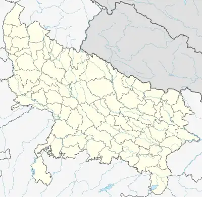 Tulsipur Location in India | |
| Coordinates: 27°33′N 82°25′E / 27.55°N 82.42°E | |
| State | Uttar Pradesh |
| District | Balrampur District |
| Elevation | 109 m (358 ft) |
| Population (2011)[1] | |
| • Total | 24,488 |
| Language | |
| • Official | Hindi |
| • Local | Awadhi[2] |
| Time zone | UTC+5:30 (IST) |
| Telephone code | 05264 |
| Vehicle registration | UP-47 |
Tulsipur is a town and tehsil in the Balrampur district of the Indian state of Uttar Pradesh.[3]
Geography
Tulsipur is located near the India-Nepal border on the banks of the River Nakti (also known as River Siria) and is 23 km from Koilabas and 190 km from the state capital Lucknow. It is located 28 km from Balrampur District.[4]
History
The House of Tulsipur ruled one of the largest Taluqs of Oudh, India, which then included the Dang and Deukhuri Valleys.
Demographics
At the 2011 Indian Census, Tulsipur had a population of 24,488, of which 12,861 were males and 11,627 were females. The population within the 0-6 year age group was 3,686. The literate population numbered 14,259, which constituted 58.2% of the population with male literacy of 63.8% and female literacy of 52.1%. The effective literacy rate of the population aged 7 and over was 68.5%, of which male literacy rate was 74.9% and female literacy rate was 61.5%. The Scheduled Castes and Scheduled Tribes population was 1,119 and 24 respectively. Tulsipur had 3,776 households in 2011.[1]
Climate
| Climate data for Tulsipur (elevation 725 m (2,379 ft), 1976–2005 normals) | |||||||||||||
|---|---|---|---|---|---|---|---|---|---|---|---|---|---|
| Month | Jan | Feb | Mar | Apr | May | Jun | Jul | Aug | Sep | Oct | Nov | Dec | Year |
| Mean daily maximum °C (°F) | 21.2 (70.2) |
23.5 (74.3) |
28.6 (83.5) |
33.2 (91.8) |
34.3 (93.7) |
33.1 (91.6) |
30.7 (87.3) |
30.8 (87.4) |
30.3 (86.5) |
29.3 (84.7) |
26.2 (79.2) |
22.6 (72.7) |
28.7 (83.6) |
| Mean daily minimum °C (°F) | 6.9 (44.4) |
8.9 (48.0) |
13.1 (55.6) |
18.4 (65.1) |
21.5 (70.7) |
23.0 (73.4) |
23.2 (73.8) |
23.0 (73.4) |
21.4 (70.5) |
16.9 (62.4) |
11.7 (53.1) |
8.1 (46.6) |
16.3 (61.4) |
| Average precipitation mm (inches) | 23.3 (0.92) |
21.5 (0.85) |
15.3 (0.60) |
20.0 (0.79) |
87.0 (3.43) |
279.2 (10.99) |
441.9 (17.40) |
412.5 (16.24) |
277.1 (10.91) |
78.4 (3.09) |
10.0 (0.39) |
15.0 (0.59) |
1,690.4 (66.55) |
| Source: Agricultural Extension in South Asia[5] | |||||||||||||
Education
| Educational Institutes | Affiliation With |
|---|---|
| Starwards Public School & College | ICSE & ISC New Delhi |
| Adi Shakti Maa Pateshwari Public School | CBSE |
| Sarashwati Sidhu Mandir | UP Board |
| Fauzan Public School | Madarsa |
| Cambridge School | UP Board |
| Swatantra Bharat Intermediate College | UP Board |
| Basant Lal intermediate College | UP Board |
| Tulsipur Public School | UP Board, Allahabad |
| Atlanta Public School | UP Board, Allahabad |
| Ishavasyam Inter College | UP Board, Allahabad |
| Sunrise Children’s Academy | UP Board, Allahabad |
| Children’s Academy | UP Board, Allahabad |
| Mahatma Gopal Das Higher Secondary School | UP Board, Allahabad |
| Tulsipur Children City Montessori School | UP Board, Allahabad |
| Kasturba Arya Balika Int College | UP Board, Allahabad |
| Akhileshwar Tiwari Girls Inter College | UP Board, Allahabad |
| Deep Narayan Singh Degree College | Siddhartha University |
| DPS Institute Chaipurwa | Siddhartha University |
| Faisal Degree College | Siddhartha University |
Transport
Air
The nearest domestic airport is Shravasti Airport and the nearest international airport is Chaudhary Charan Singh International Airport in Lucknow.
Railways
Tulsipur railway station is located in the city. Passenger, DEMU, and Express trains stop at the station.
See also
References
- 1 2 "Census of India: Tulsipur". www.censusindia.gov.in. Retrieved 20 December 2019.
- ↑ "52nd REPORT OF THE COMMISSIONER FOR LINGUISTIC MINORITIES IN INDIA" (PDF). nclm.nic.in. Ministry of Minority Affairs. Archived from the original (PDF) on 25 May 2017. Retrieved 8 June 2019.
- ↑ "Villages in Tulsipur Tehsil, Balrampur, Uttar Pradesh". Mapsofindia.com. Retrieved 12 October 2019.
- ↑ "Maps, Weather, and Airports for Tulsipur, India". www.fallingrain.com. Retrieved 20 December 2019.
- ↑ "TEMPORAL AND SPATIAL VARIABILITY OF CLIMATE CHANGE OVER NEPAL (1976-2005)" (PDF). Agricultural Extension in South Asia. Archived from the original (PDF) on 13 October 2023. Retrieved 14 October 2023.