| Tori Fatehpur | |||||||
|---|---|---|---|---|---|---|---|
| Princely Estate (Jagir) | |||||||
| 1690–1950 | |||||||
 Flag | |||||||
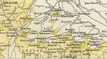
 Tori Fatehpur State in the Imperial Gazetteer of India | |||||||
| Area | |||||||
• 1901 | 93 km2 (36 sq mi) | ||||||
| Population | |||||||
• 1901 | 7,099 | ||||||
| History | |||||||
• Established | 1690 | ||||||
| 1950 | |||||||
| |||||||
Tori Fatehpur (Hindi: टोडी फतेहपुर or टोडी फ़तेहपुर), also known as Tori, was a princely state in India during the British Raj. It was one of the Hasht-Bhaiya Jagirs, under the Bundelkhand Agency of British India.[1] Today it is part of Jhansi District in the state of Uttar Pradesh.
History
Tori Fatehpur State was founded in the Bundelkhand region in 1812 by a descendant of the royal family of Orchha Diwan Rai Singh of Baragaon near Jhansi. He had eight sons who were granted Jagirs, including Dhurwai, Bijna, and Tori Fatehpur.[2]
Tori Fatehpur is on a hill near Gursarai, about 100 km from Jhansi. The fort on the hill is more than 300 years old.[3]
A part royal family started living in a town near Jhansi in the late 1880s after a massive drought and adapted a name “Biswari” for survival. After drought state lost all of its trade and other sources of fortune which resulted in downfall of state.
After Indian independence, on 1 January 1950, Tori Fatehpur acceded to the Republic of India and was merged into the Indian state of Vindhya Pradesh.
See also
References
- ↑ P. K. Bhattacharyya, Historical Geography of Madhya Pradesh from Early Records, P. 52
- ↑ Great Britain India Office. The Imperial Gazetteer of India. Oxford: Clarendon Press, 1908
- ↑ Tori Fatehpur
External links
25°27′N 79°08′E / 25.450°N 79.133°E