| Tell al-Hara | |
|---|---|
| Harith al-Jawlan, Jabal Harith | |
 Tell al-Hara from the west, 2014 | |
| Highest point | |
| Elevation | 1,127 m (3,698 ft) |
| Coordinates | 33°3′46″N 35°59′31″E / 33.06278°N 35.99194°E |
| Geography | |
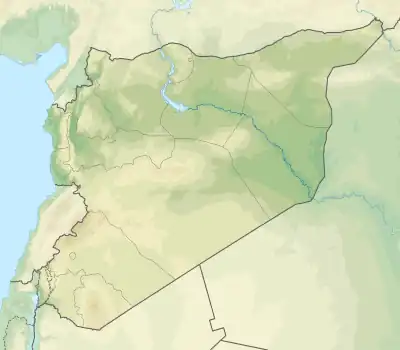
 Tell al-Hara Location of Tell al-Hara in Syria | |
| Location | Al-Sanamayn District, Daraa Governorate, Syria |
| Geology | |
| Mountain type | Conical hill |
Tell al-Ḥāra, formerly known as Ḥārith al-Jawlān or Jabal Ḥārith, is the highest point in the Daraa Governorate. During the Arab–Israeli conflict and the Syrian Civil War, it has served as a highly strategic military position because it overlooks wide areas of the Golan Heights and Hauran regions. The closest population center is the town of al-Hara, located at the hill's southeastern foot.
Description
Tell al-Hara is a conical-shaped tell (mound or hill) with an elevation of 1,127 meters (3,698 ft) above sea level.[1] Like the neighboring hills, Tell al-Hara belongs to the range of extinct volcanoes of the Jaydur region and a wide crater opens at its summit.[2] It is the highest point in the Daraa Governorate,[3] and overlooks the Hauran plain.[1] At the southeastern foot of Tell al-Hara is the town of al-Hara.[4] Damascus is 50 kilometers north of Tell al-Hara, the governorate capital Daraa is 55 kilometers to the south, the district capital al-Sanamayn is 18 kilometers to the east and the Israeli-occupied Golan Heights is 12 kilometers to the west.[5][6]
Name
Tell al-Hara was known as "Jabal Ḥārith" in the late Byzantine era.[7] It was named after the Ghassanid king al-Harith and was referred to as "Ḥārith al-Jawlān" by the contemporary Arab poets al-Nabigha and Hassan ibn Thabit.[7] The modern name of the tell and the town at its foot, "al-Ḥāra", is a "mutilated" version of its Ghassanid name "al-Ḥārith", according to historian Irfan Shahîd.[7] The tomb of the Ghassanid king al-Nu'man ibn al-Harith was said to be located at the summit of Tell al-Hara by al-Nabigha, though the scholarly consensus places al-Nu'man's tomb in the village of al-Hara.[4]
History
In the 1890s, the German archaeologist Gottlieb Schumacher noted that the tomb of a certain Muslim saint, Umar al-Shahid, "crowned" Tell al-Hara.[2] He also noted that at the hill's western foot were the ruins of an Arab monastery known as Deir al-Saj, which he suspected was of Ghassanid origin.[2]
Following Israel's occupation of the Golan Heights in 1967, Tell al-Hara served as a strategic Syrian reconnaissance point overlooking the Golan Heights.[8] It was captured by Syrian rebel forces fighting under the banners of the Free Syrian Army (FSA) and Jabhat al-Nusra from the 7th Armored Division,[5] one of the largest armored brigades of the Syrian Arab Army (SAA) in southern Syria,[6] on 5 October 2015, partially as a result of the apparent defection of SAA general Mahmoud Abu Araj.[5] Tell al-Hara's capture paved the way for the rebels' capture of much of the western Daraa Governorate and the southern Quneitra Governorate.[3] They held Tell al-Hara for about four years until Syrian government forces retook control of the hill on 7 July 2018 after a two-day battle.[3] Rebels apparently recaptured it before surrendering the hill to government forces in a reconciliation agreement on 16 July.[6]
References
- 1 2 Shahid 2002, p. 224, n. 23.
- 1 2 3 Schumacher 1897, p. 192.
- 1 2 3 Aboufadel, Leith (18 July 2018). "Syrian Army raises flag over highest point in Daraa". Al-Masdar News. Retrieved 31 October 2018.
- 1 2 Ma'oz 2008, p. 9.
- 1 2 3 Sands, Phil; Maayeh, Suha (17 March 2015). "Exclusive: The spy who fooled the Assad regime". The National. Retrieved 31 October 2018.
- 1 2 3 Xia, Li (16 July 2018). "Syrian army captures strategic hill in Daraa". Xinhua. Archived from the original on 16 July 2018. Retrieved 31 October 2018.
- 1 2 3 Shahid 2002, p. 80
- ↑ "Syria claims to capture key hilltop position overlooking Golan Heights". Times of Israel. 16 July 2018. Retrieved 31 October 2018.
Bibliography
- Ma'oz, Zvi Uri (2008). The Ghassānids and the Fall of the Golan Synagogues. Archaostyle.
- Schumacher, G. (1897). "Notes from Jedur". Quarterly Statement - Palestine Exploration Fund. 29 (3): 190–195. doi:10.1179/peq.1897.29.3.190.
- Shahîd, I. (2002). Byzantium and the Arabs in the Sixth Century, Vol. 2, Part 1. Washington, D. C.: Dumbarton Oaks Research Library and Collection. ISBN 0-88402-284-6.