| Sulphur Run Tributary to Leslie Run | |
|---|---|
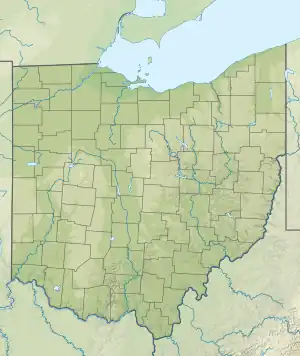
 Location of Sulphur Run mouth  Sulphur Run (Leslie Run tributary) (the United States) | |
| Location | |
| Country | United States |
| State | Ohio |
| County | Columbiana |
| City | East Palestine |
| Physical characteristics | |
| Source | Gould Pond |
| • location | about 0.5 miles north of East Palestine, Ohio |
| • coordinates | 40°51′9.00″N 080°32′13.00″W / 40.8525000°N 80.5369444°W[1] |
| • elevation | 1,110 ft (340 m)[1] |
| Mouth | Leslie Run |
• location | East Palestine, Ohio |
• coordinates | 40°49′55.22″N 080°32′40.25″W / 40.8320056°N 80.5445139°W[1] |
• elevation | 971 ft (296 m)[1] |
| Length | 2.17 mi (3.49 km)[2] |
| Basin size | 3.12 square miles (8.1 km2)[3] |
| Discharge | |
| • location | Leslie Run |
| • average | 3.87 cu ft/s (0.110 m3/s) at mouth with Leslie Run[3] |
| Basin features | |
| Progression | Leslie Run → Bull Creek → North Fork Little Beaver Creek → Little Beaver Creek → Ohio River → Mississippi River → Gulf of Mexico[2] |
| River system | Ohio River |
| Tributaries | |
| • left | unnamed tributaries |
| • right | unnamed tributaries |
| Bridges | Concord Drive, E Martin Street, E Taggart Street, N James Street, N Liberty Street, N Sumner Street, N Market Street, N Walnut Street, West Street, W Main Street |
Leslie Run is a 2.17 mi (3.49 km) long second-order tributary to Leslie Run in Columbiana County, Ohio.
Course
Sulphur Run rises in Gould Pond about 0.5 miles north of East Palestine, Ohio, and then flows south and southwest to join Leslie Run at East Palestine.[1]
Watershed
Sulphur Run drains 3.12 square miles (8.1 km2) of area, receives about 38.65 in/year of precipitation, and is about 39.63% forested.[3]
See also
References
- 1 2 3 4 5 "Geographic Names Information System". edits.nationalmap.gov. US Geological Survey. Retrieved March 22, 2023.
- 1 2 "ArcGIS Web Application". epa.maps.arcgis.com. US EPA. Retrieved March 22, 2023.
- 1 2 3 "Sulphur Run Watershed Report". watersgeo.epa.gov. US EPA. Retrieved March 22, 2023.
This article is issued from Wikipedia. The text is licensed under Creative Commons - Attribution - Sharealike. Additional terms may apply for the media files.