Stara Oselica | |
|---|---|
 | |
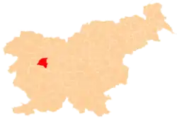
 Stara Oselica Location in Slovenia | |
| Coordinates: 46°6′21.13″N 14°4′34.13″E / 46.1058694°N 14.0761472°E | |
| Country | |
| Traditional region | Upper Carniola |
| Statistical region | Upper Carniola |
| Municipality | Gorenja Vas–Poljane |
| Area | |
| • Total | 11.57 km2 (4.47 sq mi) |
| Elevation | 799.5 m (2,623.0 ft) |
| Population (2020) | |
| • Total | 213 |
| • Density | 18/km2 (48/sq mi) |
| [1] | |
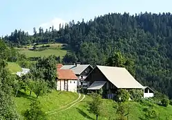
Stara Oselica (pronounced [ˈstaːɾa ˈoːsɛlitsa]; German: Altoßlitz[2]) is a dispersed settlement in the Municipality of Gorenja Vas–Poljane in the Upper Carniola region of Slovenia.[3]
Name
The name Stara Oselica literally means 'old Oselica' (in contrast to nearby Nova Oselica 'new Oselica'). The origin of the name Oselica is uncertain, but is likely derived from the common noun osel 'donkey' (or from the surname Osel derived from that noun). A less likely possibility, argued against by medieval transcriptions, is that the name is derived from the plant name oselica 'pepper-saxifrage'. The toponym Oslica has the same etymology.[4]
Church


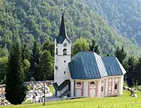
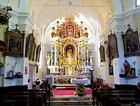
The local church is dedicated to the Conversion of Saint Paul. It is a Baroque building from the late 17th or early 18th century. Its belfry is older and was made taller at the time the current church was built. The main altar dates to the first half of the 18th century.[5]
References
- ↑ Statistical Office of the Republic of Slovenia
- ↑ Leksikon občin kraljestev in dežel zastopanih v državnem zboru, vol. 6: Kranjsko. Vienna: C. Kr. Dvorna in Državna Tiskarna. 1906. p. 58.
- ↑ Gorenja Vas–Poljane municipal site
- ↑ Snoj, Marko (2009). Etimološki slovar slovenskih zemljepisnih imen. Ljubljana: Modrijan. p. 294.
- ↑ Cultural Heritage in the Municipality of Gorenja Vas–Poljane (in Slovene)
External links
 Media related to Stara Oselica at Wikimedia Commons
- Stara Oselica on Geopedia
