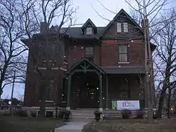
St. Joseph Neighborhood Historic District | |
 1101 North Delaware, January 2010 | |
   | |
| Location | Roughly bounded by St. Clair, Delaware and Eleventh Sts. and Central and Ft. Wayne Aves., Indianapolis, Indiana |
|---|---|
| Coordinates | 39°46′50″N 86°09′08″W / 39.78056°N 86.15222°W |
| Area | 18 acres (7.3 ha) |
| Architectural style | Queen Anne, Italianate, Commercial Style |
| NRHP reference No. | 91000794[1] |
| Added to NRHP | June 27, 1991 |
St. Joseph Neighborhood Historic District is a national historic district located at Indianapolis, Indiana. The district encompasses 57 contributing buildings in a predominantly residential section of Indianapolis. It was developed between about 1855 and 1930, and include representative examples of Italianate and Queen Anne style architecture. Located in the district are the separately listed Bals-Wocher House, William Buschmann Block, Delaware Court, Pearson Terrace, and The Spink. Other notable buildings include the Christian Place complex, Fishback-Vonnegut-New House, Henry Hilker House, Apollo-Aurora Rowhouses, Israel Traub Store (c. 1865), and Lorenzo Moody House.[2]
It was listed on the National Register of Historic Places in 1991.[1]
References
- 1 2 "National Register Information System". National Register of Historic Places. National Park Service. July 9, 2010.
- ↑ "Indiana State Historic Architectural and Archaeological Research Database (SHAARD)" (Searchable database). Department of Natural Resources, Division of Historic Preservation and Archaeology. Retrieved August 1, 2016. Note: This includes Frank Hurdis (February 1991). "National Register of Historic Places Inventory Nomination Form: St. Joseph Neighborhood Historic District" (PDF). Retrieved August 1, 2016., Site map, and Accompanying photographs
External links
 Media related to St. Joseph Neighborhood Historic District at Wikimedia Commons