Sollstedt | |
|---|---|
 Coat of arms | |
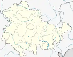
Location of Sollstedt within Nordhausen district  | |
 Sollstedt  Sollstedt | |
| Coordinates: 51°24′56″N 10°32′2″E / 51.41556°N 10.53389°E | |
| Country | Germany |
| State | Thuringia |
| District | Nordhausen |
| Government | |
| • Mayor (2022–28) | Tobias Tressel[1] (SPD) |
| Area | |
| • Total | 26.22 km2 (10.12 sq mi) |
| Elevation | 260 m (850 ft) |
| Population (2022-12-31)[2] | |
| • Total | 2,965 |
| • Density | 110/km2 (290/sq mi) |
| Time zone | UTC+01:00 (CET) |
| • Summer (DST) | UTC+02:00 (CEST) |
| Postal codes | 99759 |
| Dialling codes | 036338 |
| Vehicle registration | NDH |
| Website | www.sollstedt.de |
Sollstedt is a municipality in the district of Nordhausen, in Thuringia, Germany. On 1 January 2009, it incorporated the former municipality Rehungen. The municipality is conveniently located near the A38 motorway, making it easily accessible by car. The nearest train station is in Nordhausen, about 20 kilometers away.
History and Culture
Medieval Origins
Sollstedt's history stretches back to the Middle Ages, with evidence of settlements as early as the 9th century.
Salt Mining
For centuries, Sollstedt was a major center for salt mining, contributing significantly to the region's economy. The former Karl Marx Potash Works, a landmark mine, still stands today as a reminder of this heritage.
Reunification and Change
After German reunification in 1990, Sollstedt faced economic challenges due to the decline of the mining industry. However, the community has adapted and thrived, embracing new opportunities in tourism and sustainable development.
Cultural Attractions
Sollstedt is home to several historical landmarks, including the St. John's Church and the beautifully restored manor house, Gutshof Sollstedt. The village also hosts various cultural events throughout the year, showcasing its local traditions and talent.
Sollstedt's stunning natural surroundings offer a perfect escape for nature lovers. Hike or cycle through the picturesque Kyffhäuser mountain range or take a scenic stroll along the banks of the Wupper River.

References
- ↑ Gewählte Bürgermeister - aktuelle Landesübersicht, Freistaat Thüringen, accessed 10 November 2022.
- ↑ "Bevölkerung der Gemeinden, erfüllenden Gemeinden und Verwaltungsgemeinschaften in Thüringen Gebietsstand: 31.12.2022" (in German). Thüringer Landesamt für Statistik. June 2023.