Slidre | |
|---|---|
Village | |
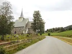
 View of the road past Slidredomen | |
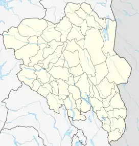
 Slidre Location of the village  Slidre Slidre (Norway) | |
| Coordinates: 61°05′17″N 8°58′53″E / 61.08802°N 8.98141°E | |
| Country | Norway |
| Region | Eastern Norway |
| County | Innlandet |
| District | Valdres |
| Municipality | Vestre Slidre Municipality |
| Area | |
| • Total | 0.47 km2 (0.18 sq mi) |
| Elevation | 397 m (1,302 ft) |
| Population (2021)[1] | |
| • Total | 337 |
| • Density | 771/km2 (2,000/sq mi) |
| Time zone | UTC+01:00 (CET) |
| • Summer (DST) | UTC+02:00 (CEST) |
| Post Code | 2966 Slidre |
Slidre is the administrative centre of Vestre Slidre Municipality in Innlandet county, Norway. The village is located along the Slidrefjorden in the Valdres district. The village is located along the European route E16 highway, about 25 kilometres (16 mi) northwest of Fagernes.[3][4]
The 0.47-square-kilometre (120-acre) village has a population (2021) of 337 and a population density of 771 inhabitants per square kilometre (2,000/sq mi).[1]
History
Slidre is the site of the Slidredomen, a medieval era stone church.
The village was the administrative centre of the old Slidre Municipality from 1838 until 1849 when the municipality was divided.[3]
Name
The municipality (and the parish) were named after the old Slidre farm (Old Norse: Slíðrar or Slíðrir) since this was the location of the first Slidre Church that was built during the 12th century. The meaning of the name is not definitively known. It could be derived from the word slir which means the narrow depression through which a river runs.[5][3]
References
- 1 2 3 Statistisk sentralbyrå (1 January 2021). "Urban settlements. Population and area, by municipality".
- ↑ "Slidre, Vestre Slidre". yr.no. Retrieved 11 August 2022.
- 1 2 3 Mæhlum, Lars, ed. (12 February 2020). "Slidre". Store norske leksikon (in Norwegian). Kunnskapsforlaget. Retrieved 11 August 2022.
- ↑ Mæhlum, Lars, ed. (29 March 2022). "Slidre (tettsted)". Store norske leksikon (in Norwegian). Kunnskapsforlaget. Retrieved 11 August 2022.
- ↑ Rygh, Oluf (1900). Norske gaardnavne: Kristians amt (in Norwegian) (4 ed.). Kristiania, Norge: W. C. Fabritius & sønners bogtrikkeri. p. 285.