| Sierra de Baza | |
|---|---|
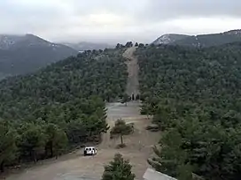 Firebreak in Sierra de Baza | |
| Highest point | |
| Peak | Calar de Santa Bárbara |
| Elevation | 2,269 m (7,444 ft) |
| Prominence | 850 |
| Coordinates | 37°23′00″N 02°50′36″W / 37.38333°N 2.84333°W |
| Geography | |
 Sierra de Baza Location in Spain | |
| Location | Granada province, Andalusia |
| Country | Spain |
| Parent range | Penibaetic System |
| Geology | |
| Mountain type | Limestone |
| Climbing | |
| Easiest route | From Baza |
Sierra de Baza is a mountain range near the city of Baza in the Granada province in Spain. It is named after the town of Baza and its highest point is the 2,269 m high Calar de Santa Bárbara.
It is located between the Sierra Nevada and the Sierra de Cazorla and Sierra de Segura mountain ranges.[1] It merges towards the east with the Sierra de los Filabres mountain range.
A natural park, the Parque natural de la Sierra de Baza, has been designated to protect the mountain environment. A long-distance footpath, the GR 7, passes through the natural park.
See also
References
External links
Wikimedia Commons has media related to Sierra de Baza.
This article is issued from Wikipedia. The text is licensed under Creative Commons - Attribution - Sharealike. Additional terms may apply for the media files.