Sitaro Islands Regency
Kabupaten Kepulauan Sitaro Kabupaten Kepulauan Siau Tagulandang Biaro | |
|---|---|
 Seal | |
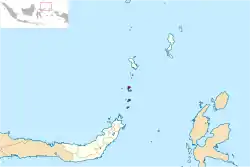 Location within North Sulawesi | |
| Coordinates: 2°45′56″N 125°24′13″E / 2.76556°N 125.40361°E | |
| Country | |
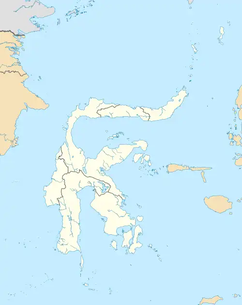
| Province | North Sulawesi |
| Capital | Ondong |
| Government | |
| • Regent | Toni Supit |
| • Vice Regent | Siska Salindeho |
| Area | |
| • Total | 275.95 km2 (106.54 sq mi) |
| Population (mid 2022 estimate)[1] | |
| • Total | 72,517 |
| • Density | 260/km2 (680/sq mi) |
| Time zone | UTC+8 (Indonesia Central Time) |
| Area code | (+62) 432 |
| Website | sitarokab.go.id |
Sitaro Islands Regency (Indonesian: Kabupaten Kepulauan Sitaro, although its formal name is Kabupaten Kepulauan Siau Tagulandang Biaro) is a regency located off the northern extremity of Sulawesi Island in the southern Sangihe Islands, North Sulawesi Province, Indonesia. The regency was formed under Law Number 15 Year 2007 from 2 January 2007 (Indonesian: Undang-Undang Nomor 15 Tahun 2007), by separation from the Sangihe Islands Regency of which it had previously formed the southern part. The short form of the name is formed from those of the three principal islands — Siau, Tagulandang and Biaro.
The main island is Siau, while further south (nearer Sulawesi) are Tagulandang and Biaro. The regency's area is 275.95 km2 and the total population was 63,801 at the 2010 census[2] and 71,817 at the 2020 census;[3] the official estimate as at mid 2022 was 72,517.[1] Most of the population are fishermen and farmers. The religion of the majority of the population is Christianity and Catholicism, but there are also followers of Islam and Buddhism. The main town and administrative centre is Ulu Siau.
Administrative districts
The regency is divided into ten districts (kecamatan), tabulated below with their areas and their populations at the 2010 census[2] and 2020 census,[3] together with the official estimates as at mid 2022.[1] The table also includes the locations of the district administrative centres, the number of administrative villages (totaling 83 rural desa and 10 urban kelurahan) in each district, and its postal codes.
| Kode Wilayah | Name of District (kecamatan) | Area in km2 | Pop'n census 2010 | Pop'n census 2020 | Pop'n estimate mid 2022 | Admin centre | No. of villages | Post codes |
|---|---|---|---|---|---|---|---|---|
| 71.09.07 | Biaro (a) | 20.85 | 3,248 | 3,717 | 3,765 | Lamanggo | 5 | 95864 |
| 71.09.10 | Tagulandang Selatan (South Tagulandang) | 21.63 | 4,171 | 4,875 | 4,958 | Kisihang | 6 | 95866 |
| 71.09.03 | Tagulandang (b) (West Tagulandang) | 55.53 | 11,597 | 13,215 | 13,374 | Buhias | 15 (c) | 95863 |
| 71.09.06 | Tagulandang Utara (North Tagulandang) | 17.92 | 4,027 | 4,206 | 4,186 | Bawoleu | 6 | 95865 |
| 71.09.05 | Siau Barat Selatan (Southwest Siau) | 15.10 | 4,073 | 4,584 | 4,628 | Talawid | 7 | 95868 |
| 71.09.04 | Siau Timur Selatan (d) (Southeast Siau) | 24.06 | 7,283 | 8,533 | 8,682 | Sawang | 14 | 95867 |
| 71.09.02 | Siau Barat (e) (West Siau) | 34.92 | 7,849 | 8,799 | 8,877 | Ondong | 12 (f) | 95862 |
| 71.09.09 | Siau Tengah (Central Siau) | 11.80 | 1,850 | 2,040 | 2,052 | Beong | 4 | 95860 |
| 71.09.01 | Siau Timur (g) (East Siau) | 55.94 | 15,816 | 17,610 | 17,742 | Ulu Siau | 16 (h) | 95861 |
| 71.09.08 | Siau Barat Utara (i) (Northwest Siau) | 15.20 | 3,887 | 4,238 | 4,253 | Hiung | 8 | 95869 |
| Totals | 275.95 | 63,801 | 71,817 | 72,517 | Ulu Siau | 94 |
Notes: (a) including 20 small offshore islands. (b) including the offshore islands of Pulau Ruang (fourth largest in the regency), Pulau Pasige and 2 smaller.
(c) includes 2 kelurahan - Bahoi and Balehumara. (d) includes the small offshore island of Pulau Batuguhita.
(e) includes the offshore islands of Pulau Makaleki and the small Pulau Batuhasaho. (f) includes 3 kelurahan - Ondong, Paniki and Paseng.
(g) including the offshore islands of Pulau Pahepa, Pulau Gunatin, Pulau Mahoro and 13 smaller.
(h) includes 5 kelurahan - Akesimbeka, Bahu, Bebali, Tarorane and Tatahadeng. (i) includes the offshore islands of Pulau Batupuki Sewenahe and Pulau Timuhe.
Climate
Ondong, the seat of the regency has a tropical rainforest climate (Af) with heavy to very heavy rainfall year-round.
| Climate data for Ondong | |||||||||||||
|---|---|---|---|---|---|---|---|---|---|---|---|---|---|
| Month | Jan | Feb | Mar | Apr | May | Jun | Jul | Aug | Sep | Oct | Nov | Dec | Year |
| Mean daily maximum °C (°F) | 29.9 (85.8) |
30.1 (86.2) |
30.4 (86.7) |
31.2 (88.2) |
31.1 (88.0) |
31.0 (87.8) |
30.9 (87.6) |
31.5 (88.7) |
31.6 (88.9) |
31.6 (88.9) |
31.1 (88.0) |
30.4 (86.7) |
30.9 (87.6) |
| Daily mean °C (°F) | 25.0 (77.0) |
26.1 (79.0) |
26.3 (79.3) |
26.7 (80.1) |
26.8 (80.2) |
26.7 (80.1) |
26.5 (79.7) |
26.9 (80.4) |
26.8 (80.2) |
26.8 (80.2) |
26.7 (80.1) |
26.4 (79.5) |
26.5 (79.7) |
| Mean daily minimum °C (°F) | 22.0 (71.6) |
22.1 (71.8) |
22.2 (72.0) |
22.3 (72.1) |
22.6 (72.7) |
22.4 (72.3) |
22.1 (71.8) |
22.3 (72.1) |
22.0 (71.6) |
22.1 (71.8) |
22.4 (72.3) |
22.4 (72.3) |
22.2 (72.0) |
| Average rainfall mm (inches) | 407 (16.0) |
308 (12.1) |
299 (11.8) |
273 (10.7) |
279 (11.0) |
250 (9.8) |
216 (8.5) |
166 (6.5) |
180 (7.1) |
228 (9.0) |
328 (12.9) |
374 (14.7) |
3,308 (130.1) |
| Source: Climate-Data.org[4] | |||||||||||||