Native name: Pulau Serasan | |
|---|---|
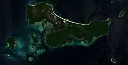
 A satellite image of the district | |
 Serasan  Serasan | |
| Geography | |
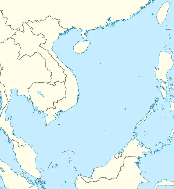
| Location | South China Sea |
| Coordinates | 2°30′52″N 109°02′41″E / 2.5145°N 109.04485°E |
| Archipelago | Natuna Islands |
| Area | 44.72 km2 (17.27 sq mi) |
| Highest elevation | 2 m (7 ft) |
| Administration | |
| Province | Riau Islands |
| Regency | Natuna Islands |
| Archipelago | South Natuna |
| Largest settlement | Serasan |
| Demographics | |
| Population | 5,505 (2022) |
| Pop. density | 123.10/km2 (318.83/sq mi) |
| Ethnic groups | Malays |
| Additional information | |
| Time zone | |
| Language: Natuna Malay | |
Serasan is a district in the Natuna Regency, Riau Islands, Indonesia.[1] There are 34 named islands, 4 inhabited islands and 7 villages in the district.[2]
Villages
There are 7 villages in the Serasan District.[3] 5 villages use a spring for water, 1 uses a well, and 1 uses refillable water. All 7 villages use kerosene for cooking, and there are 1,566 families using electricity. The district is almost all Muslim, with 98.75% of the population practicing Islam, and the rest being Christian or Buddhist. There are 8 mosques in the district, with 1 in each village and 2 in Serasan. There are also 6 musallas, 1 in Jermalik and Tanjung Balau, and 2 in Pangkalan and Serasan. There are 17 sports facilities in the district. Each town has a volleyball court, 5 have a soccer field, 4 have a table tennis facility, and there is also 1 futsal, billiards, badminton and court tennis facility in the district. There are 3 lodges in the district, 3 in Serasan and 1 in Tanjung Setelung. There is public transportation in 6 villages, although there are no fixed routes. All villages also have asphalt or concrete roads open throughout the year. There is an operational post office in the village of Serasan with the postal code of 29781. There are 4 cell towers in the district, and at least 1 communication service operators serves the villages. All but 2 villages have 4G LTE, with Tanjung Balau and Pangkalan only having 2.5G. There are 8 restaurants on the island, with all but 1 in Serasan.[4]
| Village | Area (km²) | % of subdistrict area | Terrian |
|---|---|---|---|
| Kampung Hilir (id) | 1.60 | 3.58 | Plains |
| Batu Berian (id) | 8.15 | 18.22 | Slopes |
| Tanjung Setelung (id) | 3.53 | 7.90 | Slopes |
| Tanjung Balau (id) | 3.05 | 6.82 | Slopes |
| Pangkalan (id) | 6.06 | 13.56 | Plains |
| Jermalik (id) | 17.33 | 38.76 | Plains |
| Serasan | 4.99 | 11.66 | Plains |
| Village | Males | Females | Total | % of total population |
|---|---|---|---|---|
| Kampung Hilir | 270 | 257 | 527 | 9.87 |
| Batu Berian | 362 | 366 | 728 | 13.63 |
| Tanjung Setelung | 329 | 308 | 637 | 11.93 |
| Tanjung Balau | 255 | 219 | 474 | 8.87 |
| Pangkalan | 278 | 259 | 537 | 10.05 |
| Jermalik | 231 | 204 | 435 | 8.14 |
| Serasan | 1,011 | 992 | 2,003 | 37.50 |
| Total | 2,736 | 2,605 | 5,341 | 100.00 |
| Village | Population density (km²) | Sex ratio | # of households |
|---|---|---|---|
| Kampung Hilir | 329.58 | 105.06 | 167 |
| Batu Berian | 89.36 | 98.91 | 219 |
| Tanjung Setelung | 180.23 | 106.82 | 186 |
| Tanjung Balau | 155.53 | 116.44 | 158 |
| Pangkalan | 88.57 | 107.34 | 163 |
| Jermalik | 25.10 | 113.24 | 129 |
| Serasan | 401.23 | 101.92 | 691 |
| Total | 119.44 | 105.03 | 1,713 |
Education
| Type of school | # of schools⠀⠀⠀⠀⠀⠀⠀Students⠀⠀⠀⠀⠀⠀⠀⠀Teachers | |||||
|---|---|---|---|---|---|---|
| Public | Private | Public | Private | Public | Private | |
| Kindergarten | 1 | 6 | 81 | 99 | 11 | 17 |
| Raudhatul Athfal (id) | 0 | 2 | 0 | 68 | 0 | 10 |
| Elementary School | 7 | 0 | 559 | 0 | 89 | 0 |
| Junior High School | 3 | 0 | 239 | 0 | 40 | 0 |
| Madrasah Tsanawiyah (id) | 0 | 1 | 0 | 62 | 0 | 14 |
| Senior High School | 1 | 0 | 277 | 0 | 31 | 0 |
| Total | 12 | 9 | 1156 | 229 | 171 | 41 |
History
On March 6, 2023, landslides caused by heavy rains on the islands, killed 50 and left many missing.[5]
References
- ↑ "GeoNames.org". www.geonames.org. Retrieved 2023-03-07.
- ↑ "Serasan District". Nomor.net.
- ↑ "List of places (villages) in Serasan District, Natuna Regency".
- ↑ "BPS Kabupaten Natuna". natunakab.bps.go.id. Retrieved 2023-03-09.
- ↑ "Update Longsor Natuna: Korban Meninggal Jadi 50 Orang". nasional (in Indonesian). Retrieved 2023-04-03.