Selovec | |
|---|---|
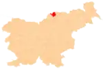
 Selovec Location in Slovenia | |
| Coordinates: 46°32′34.4″N 15°2′6.32″E / 46.542889°N 15.0350889°E | |
| Country | |
| Traditional region | Carinthia |
| Statistical region | Carinthia |
| Municipality | Dravograd |
| Area | |
| • Total | 7.59 km2 (2.93 sq mi) |
| Elevation | 508 m (1,667 ft) |
| Population (2020) | |
| • Total | 501 |
| • Density | 66/km2 (170/sq mi) |
| [1] | |
Selovec (pronounced [sɛˈlɔːʋəts] or [sɛˈloːʋəts]) is a dispersed settlement in the hills south of Dravograd in the Carinthia region in northern Slovenia.[2]
Mass graves
Selovec is the site of three known mass graves or unmarked graves associated with the Second World War. The Jeglijenek Meadow Mass Grave (Slovene: Grobišče Jeglijenkov travnik) is located in a meadow 50 meters (160 ft) southeast of the house at Selovec no. 16. It is a clearly visible mound containing the remains of two soldiers: a Croatian and a Cossack.[3] The Bricl Mass Grave (Grobišče Bricl) lies in a meadow 50 meters (160 ft) west of the Bricelj farm at Selovec no. 13. It contains the remains of five to 12 Croatian soldiers.[4] The Zdih Woods Grave (Grobišče Zdihov gozd) is located 400 meters (1,300 ft) southwest of the house at Selovec no. 15. It contains the remains of one Croatian soldier.[5]
References
- ↑ Statistical Office of the Republic of Slovenia
- ↑ Dravograd municipal site
- ↑ Ferenc, Mitja (December 2009). "Grobišče Jeglijenkov travnik". Geopedia (in Slovenian). Ljubljana: Služba za vojna grobišča, Ministrstvo za delo, družino in socialne zadeve. Retrieved November 29, 2023.
- ↑ Ferenc, Mitja (December 2009). "Grobišče Bricl". Geopedia (in Slovenian). Ljubljana: Služba za vojna grobišča, Ministrstvo za delo, družino in socialne zadeve. Retrieved November 29, 2023.
- ↑ Ferenc, Mitja (December 2009). "Grobišče Zdihov gozd". Geopedia (in Slovenian). Ljubljana: Služba za vojna grobišča, Ministrstvo za delo, družino in socialne zadeve. Retrieved November 29, 2023.
External links
