Highway 155 | ||||
|---|---|---|---|---|
| Route information | ||||
| Maintained by Ministry of Highways and Infrastructure | ||||
| Length | 298.9 km[1] (185.7 mi) | |||
| Existed | 1947–present | |||
| Major junctions | ||||
| South end | ||||
| North end | ||||
| Location | ||||
| Country | Canada | |||
| Province | Saskatchewan | |||
| Highway system | ||||
|
| ||||
| ||||
.svg.png.webp)
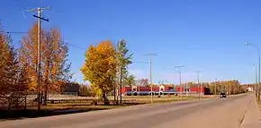
Highway 155 is a paved, undivided provincial highway in the Canadian province of Saskatchewan. It runs from Highway 55 near Green Lake until La Loche, where it intersects with Highway 955. The highway services several communities and provincial recreation sites and is entirely within the Northern Saskatchewan Administration District. It is about 299 kilometres (186 mi) long.
Communities accessible directly from Highway 155 are Green Lake, Buffalo Narrows, Bear Creek, and La Loche. Some of the parks accessed from the highway include Beatty Lake Recreation Site,[2] Beaver / Cowan Rivers Recreation Site, Buffalo Narrows Sand Dunes Park,[3] and Waterhen River Recreation Site.
History
Highway 155 was begun in 1947 as a development road. It reached Buffalo Narrows in 1957 where a ferry was needed to cross the Kisis Channel. The road closely followed the path of the old wagon trail established by the Hudson's Bay Company.[4] The official opening of Highway 155 from Green Lake to Buffalo Narrows was held in August 1963 in Green Lake. The old trail to La Loche was rebuilt soon after to become part of Highway 155.
A bridge built in 1981 now crosses the Kisis Channel next to where the ferry was once located. The Kisis Channel connects Churchill Lake to Peter Pond Lake. In the 1980s, the highway was straightened and paved.
Major intersections
From south to north:
| Location | km[1] | mi | Destinations | Notes | |
|---|---|---|---|---|---|
| Green Lake | 0.0 | 0.0 | Southern terminus | ||
| | 94.3 | 58.6 | |||
| | 99.4 | 61.8 | |||
| | 153.6 | 95.4 | |||
| | 186.2 | 115.7 | |||
| Buffalo Narrows | 195.2 | 121.3 | Crosses Kisis Channel (connects Peter Pond Lake and Churchill Lake) | ||
| | 254.8 | 158.3 | South of Bear Creek | ||
| | 288.3 | 179.1 | Winter road connection to Fort McMurray, Alberta | ||
| La Loche | 298.9 | 185.7 | Northern terminus | ||
| 1.000 mi = 1.609 km; 1.000 km = 0.621 mi | |||||
See also
References
- 1 2 Google (17 February 2018). "Highway 155 in Saskatchewan" (Map). Google Maps. Google. Retrieved 17 February 2018.
- ↑ "Beatty Lake Campground". Tourism Saskatchewan. Government of Saskatchewan. Retrieved 1 September 2023.
- ↑ "Big Buffalo Beach". Tourism Saskatchewan. Government of Saskatchewan. Retrieved 1 September 2023.
- ↑ Dunfield, H. C. "Northernmost Highway Serves Historic Frontier Area". Star-Phoenix. Saskatoon. pp. 8 (1963-08-20).
External links
 Media related to Saskatchewan Highway 155 at Wikimedia Commons