Sant'Antonino | |
|---|---|
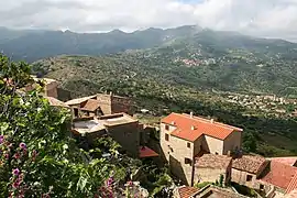 Sant'Antonino, and the villages of the Balagne | |
Location of Sant'Antonino | |
 Sant'Antonino 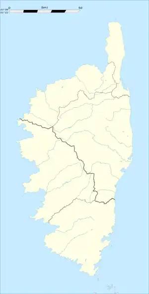 Sant'Antonino | |
| Coordinates: 42°35′24″N 8°54′20″E / 42.59°N 8.9056°E | |
| Country | France |
| Region | Corsica |
| Department | Haute-Corse |
| Arrondissement | Calvi |
| Canton | Calvi |
| Intercommunality | Calvi Balagne |
| Government | |
| • Mayor (2020–2026) | Roxane Barthelemy[1] |
| Area 1 | 4.1 km2 (1.6 sq mi) |
| Population | 138 |
| • Density | 34/km2 (87/sq mi) |
| Time zone | UTC+01:00 (CET) |
| • Summer (DST) | UTC+02:00 (CEST) |
| INSEE/Postal code | 2B296 /20220 |
| Elevation | 138–521 m (453–1,709 ft) (avg. 497 m or 1,631 ft) |
| 1 French Land Register data, which excludes lakes, ponds, glaciers > 1 km2 (0.386 sq mi or 247 acres) and river estuaries. | |
Sant'Antonino (French pronunciation: [sɑ̃t‿ɑ̃tɔnino]) is a commune in the Haute-Corse department of France on the island of Corsica. It is one of Les Plus Beaux Villages de France.
Population
| Year | Pop. | ±% p.a. |
|---|---|---|
| 1968 | 121 | — |
| 1975 | 113 | −0.97% |
| 1982 | 79 | −4.98% |
| 1990 | 60 | −3.38% |
| 1999 | 77 | +2.81% |
| 2007 | 91 | +2.11% |
| 2012 | 107 | +3.29% |
| 2017 | 127 | +3.49% |
| Source: INSEE[3] | ||
See also
References
- ↑ "Répertoire national des élus: les maires". data.gouv.fr, Plateforme ouverte des données publiques françaises (in French). 2 December 2020.
- ↑ "Populations légales 2021". The National Institute of Statistics and Economic Studies. 28 December 2023.
- ↑ Population en historique depuis 1968, INSEE
Wikimedia Commons has media related to Sant'Antonino (Haute-Corse).
This article is issued from Wikipedia. The text is licensed under Creative Commons - Attribution - Sharealike. Additional terms may apply for the media files.