Avapessa | |
|---|---|
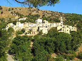 A general view of Avapessa | |
Location of Avapessa | |
 Avapessa 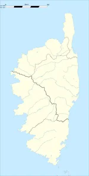 Avapessa | |
| Coordinates: 42°33′44″N 8°53′43″E / 42.5622°N 8.8953°E | |
| Country | France |
| Region | Corsica |
| Department | Haute-Corse |
| Arrondissement | Calvi |
| Canton | Calvi |
| Intercommunality | CC Calvi Balagne |
| Government | |
| • Mayor (2020–2026) | Marie-Josée Salvatori[1] |
| Area 1 | 3.29 km2 (1.27 sq mi) |
| Population | 82 |
| • Density | 25/km2 (65/sq mi) |
| Time zone | UTC+01:00 (CET) |
| • Summer (DST) | UTC+02:00 (CEST) |
| INSEE/Postal code | 2B025 /20225 |
| Elevation | 173–800 m (568–2,625 ft) (avg. 150 m or 490 ft) |
| 1 French Land Register data, which excludes lakes, ponds, glaciers > 1 km2 (0.386 sq mi or 247 acres) and river estuaries. | |
Avapessa is a commune in the Haute-Corse department of France on the island of Corsica.
The inhabitants of the commune are known as Avapessiens or Avapessiennes.[3]
Geography

View of the valley
Avapessa is located some 12 km in a direct line east of Calvi and 8 km south by south-east of Algajola. Access to the commune is by road D71 from Cateri in the north which passes through the heart of the commune slightly west of the village and continues south-east to Muro. Access to the village is by the Tuvo road which branches off the D71. The commune is rugged in the west with a high country landscape while in the east there is more farmland.[4]
Neighbouring communes and villages
Places adjacent to Avapessa | ||||||||||||||||
|---|---|---|---|---|---|---|---|---|---|---|---|---|---|---|---|---|
| ||||||||||||||||
Administration
List of Successive Mayors[5]
| From | To | Name | Party |
|---|---|---|---|
| 2001 | 2008 | Christian Reboul | DVD |
| 2008 | 2026 | Marie-Josée Salvatori | DVG |
Demography
In 2017 the commune had 82 inhabitants.
|
| |||||||||||||||||||||||||||||||||||||||||||||||||||||||||||||||||||||||||||||||||||||||||||||||||||||||||||||||
| Source: EHESS[6] and INSEE[7] | ||||||||||||||||||||||||||||||||||||||||||||||||||||||||||||||||||||||||||||||||||||||||||||||||||||||||||||||||

Skycrane fire fighting at Avapessa
See also
References
- ↑ "Répertoire national des élus: les maires". data.gouv.fr, Plateforme ouverte des données publiques françaises (in French). 2 December 2020.
- ↑ "Populations légales 2020". The National Institute of Statistics and Economic Studies. 29 December 2022.
- ↑ Inhabitants of Haute-Corse (in French)
- 1 2 Google Maps
- ↑ List of Mayors of France (in French)
- ↑ Des villages de Cassini aux communes d'aujourd'hui: Commune data sheet Avapessa, EHESS (in French).
- ↑ Population en historique depuis 1968, INSEE
External links
- Avapessa official website Archived 27 March 2012 at the Wayback Machine (in French)
- Avapessa on Géoportail, National Geographic Institute (IGN) website (in French)
Wikimedia Commons has media related to Avapessa.
This article is issued from Wikipedia. The text is licensed under Creative Commons - Attribution - Sharealike. Additional terms may apply for the media files.