Sainte-Geneviève | |
|---|---|
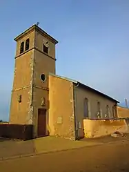 The church in Sainte-Geneviève | |
.svg.png.webp) Coat of arms | |
Location of Sainte-Geneviève | |
 Sainte-Geneviève  Sainte-Geneviève | |
| Coordinates: 48°52′16″N 6°06′59″E / 48.8711°N 6.1164°E | |
| Country | France |
| Region | Grand Est |
| Department | Meurthe-et-Moselle |
| Arrondissement | Nancy |
| Canton | Entre Seille et Meurthe |
| Intercommunality | Bassin de Pont-à-Mousson |
| Government | |
| • Mayor (2020–2026) | Loïc Fortel[1] |
| Area 1 | 7.14 km2 (2.76 sq mi) |
| Population | 193 |
| • Density | 27/km2 (70/sq mi) |
| Time zone | UTC+01:00 (CET) |
| • Summer (DST) | UTC+02:00 (CEST) |
| INSEE/Postal code | 54474 /54700 |
| Elevation | 197–376 m (646–1,234 ft) (avg. 336 m or 1,102 ft) |
| 1 French Land Register data, which excludes lakes, ponds, glaciers > 1 km2 (0.386 sq mi or 247 acres) and river estuaries. | |
Sainte-Geneviève is a commune in the Meurthe-et-Moselle department in north-eastern France.[3]
See also
References
- ↑ "Répertoire national des élus: les maires". data.gouv.fr, Plateforme ouverte des données publiques françaises (in French). 9 August 2021.
- ↑ "Populations légales 2021". The National Institute of Statistics and Economic Studies. 28 December 2023.
- ↑ INSEE commune file
Wikimedia Commons has media related to Sainte-Geneviève (Meurthe-et-Moselle).
This article is issued from Wikipedia. The text is licensed under Creative Commons - Attribution - Sharealike. Additional terms may apply for the media files.