Sai Buri
สายบุรี | |
|---|---|
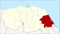 District location in Pattani province | |
| Coordinates: 6°42′5″N 101°37′3″E / 6.70139°N 101.61750°E | |
| Country | Thailand |
| Province | Pattani |
| Seat | Taluban |
| Area | |
| • Total | 178.424 km2 (68.890 sq mi) |
| Population (2009) | |
| • Total | 64,260 |
| • Density | 353.6/km2 (916/sq mi) |
| Time zone | UTC+7 (ICT) |
| Postal code | 94110 |
| Geocode | 9407 |
Sai Buri (Thai: สายบุรี, pronounced [sǎːj bū.rīː]) is a district (amphoe) in Pattani province, southern Thailand.
The local Malay people call it Teluban (Jawi: تلوبن), which is also the name of the only municipal area of the district, or Selindung Bayu (Jawi: سليندوڠ بايو), the Malay and Sanskrit word for 'wind shelter'.
Geography
Neighboring districts are (from the southeast clockwise): Mai Kaen of Pattani Province; Bacho of Narathiwat province; Kapho, Thung Yang Daeng, and Panare of Pattani. To the east is the Gulf of Thailand.
History

Sai Buri was one of the seven mueangs into which the Pattani sultanate was split. In the thesaphiban administrative reforms at the beginning of the 20th century it became a province within the Monthon Pattani. In 1909 the area of the province was reduced by reassigning Yi-Ngo and modern-day Mueang Narathiwat Districts to Mueang Bang Nara, now Narathiwat Province. In 1932 the province was abolished, the northern half was added to Pattani Province and the southern part to Narathiwat.[2]
Originally simply named "Mueang", the district was renamed "Taluban" in 1917.[3] In 1938 the district was renamed "Sai Buri".[4]
Administration
The district is divided into 11 sub-districts (tambons), which are further subdivided into 64 villages (mubans). Taluban is a sub-district municipality (thesaban tambon), which encompasses tambon Taluban. Each of the other sub-districts has a tambon administrative organization (TAO).
| No. | Name | Thai | Muban | Pop.[5] |
|---|---|---|---|---|
| 1. | Taluban | ตะลุบัน | - | 13,797 |
| 2. | Tabing | ตะบิ้ง | 6 | 5,835 |
| 3. | Pase Yawo | ปะเสยะวอ | 7 | 7,754 |
| 4. | Bang Kao | บางเก่า | 4 | 3,166 |
| 5. | Bue Re | บือเระ | 4 | 2,950 |
| 6. | Tro Bon | เตราะบอน | 11 | 7,648 |
| 7. | Kadunong | กะดุนง | 8 | 5,000 |
| 8. | Lahan | ละหาร | 5 | 4,972 |
| 9. | Manang Dalam | มะนังดาลำ | 6 | 6,776 |
| 10. | Paen | แป้น | 8 | 4,555 |
| 11. | Thung Khla | ทุ่งคล้า | 5 | 1,807 |
References
- ↑ Timtsunami8 (2020-08-31), English: An updated version of the map, retrieved 2021-06-21
{{citation}}: CS1 maint: numeric names: authors list (link) - ↑ พระบรมราชโองการ ประกาศ ยุบรวมท้องที่บางมณฑลและบางจังหวัด (PDF). Royal Gazette (in Thai). 48 (ก): 576–578. 1932-02-21. Archived from the original (PDF) on April 9, 2008.
- ↑ ประกาศกระทรวงมหาดไทย เรื่อง เปลี่ยนชื่ออำเภอ (PDF). Royal Gazette (in Thai). 34 (ก): 40–68. 1917-04-29. Archived from the original (PDF) on November 7, 2011.
- ↑ พระราชกฤษฎีกาเปลี่ยนนามจังหวัด และอำเภอบางแห่ง พุทธศักราช ๒๔๘๑ (PDF). Royal Gazette (in Thai). 55 (ก): 658–666. 1938-11-14. Archived from the original (PDF) on November 8, 2011.
- ↑ "Population statistics 2009". Department of Provincial Administration.
External links
- amphoe.com (in Thai)
| Historical divisions |
| ||||
|---|---|---|---|---|---|
| Former provinces |
| ||||