Sámsonháza
Šamšon | |
|---|---|
Village (község) | |
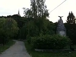
 World War I memorial. Church tower in background. | |
 Location of Nograd County in Hungary | |
 Sámsonháza Location of Sámsonháza in Hungary | |
| Coordinates: 47°59′13″N 19°43′25″E / 47.98694°N 19.72361°E | |
| Country | |
| Region | Northern Hungary |
| County | Nógrád County |
| District | Salgótarján |
| Government | |
| • Mayor | Bajnokné Képes Gyöngyi (Ind.) |
| Area | |
| • Total | 12.71 km2 (4.91 sq mi) |
| Population (1 Jan. 2015) | |
| • Total | 265 |
| • Density | 21/km2 (50/sq mi) |
| Time zone | UTC+1 (CET) |
| • Summer (DST) | UTC+2 (CEST) |
| Postal code | 3074 |
| Area code | 32 |
| Website | http://samsonhaza.hu/ |
Sámsonháza (Slovak: Šamšon) is a village in Nógrád County, Northern Hungary Region, Hungary.[1]
References
- ↑ "Central Statistical Office". KSH. Retrieved 24 December 2017.
This article is issued from Wikipedia. The text is licensed under Creative Commons - Attribution - Sharealike. Additional terms may apply for the media files.
