Roderesch | |
|---|---|
 Inn van Es at Roderesch | |
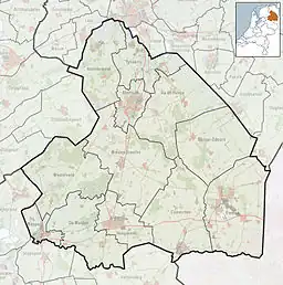
 Roderesch Location in province of Drenthe in the Netherlands  Roderesch Roderesch (Netherlands) | |
| Coordinates: 53°06′51″N 6°25′30″E / 53.1143°N 6.4250°E | |
| Country | Netherlands |
| Province | Drenthe |
| Municipality | Noordenveld |
| Area | |
| • Total | 0.39 km2 (0.15 sq mi) |
| Elevation | 7 m (23 ft) |
| Population (2021)[1] | |
| • Total | 250 |
| • Density | 640/km2 (1,700/sq mi) |
| Time zone | UTC+1 (CET) |
| • Summer (DST) | UTC+2 (CEST) |
| Postal code | 9305 |
| Dialing code | 050 |
Roderesch is a village in the Netherlands, and is part of the Noordenveld municipality in Drenthe.
History
Roderesch is an esdorp which developed in the 19th century during the excavation of peat.[3] It was first mentioned in the 1850s as "Roonder Esch", a (farm) field on higher ground near Roden.[4] In 1913, the first school was established in the village. There are several forests around Roderesch.[5]
Work camp
In 1930, it was decided to build a work camp for the unemployed near Roderesch. In 1934, construction started on the 6 hectares (15 acres) terrain. It opened in 1936, and groups of about 140 men stayed in the camp for nine weeks. During World War II, it was first used the Germans and later the Canadians. In 1955, a youth hostel was opened in the camp which closed in 1985. Since 1996, it is in private ownership for group accommodations as De Zwerfsteen.[6]
Gallery
 Former work camp Roden. Nowadays De Zwerfsteen
 Heideborch near Roderesch
References
- 1 2 "Kerncijfers wijken en buurten 2021". Central Bureau of Statistics. Retrieved 10 March 2022.
- ↑ "Postcodetool for 9305TA". Actueel Hoogtebestand Nederland (in Dutch). Het Waterschapshuis. Retrieved 10 March 2022.
- ↑ "Roderesch". Geheugen van Drenthe (in Dutch). Retrieved 10 March 2022.
- ↑ "Roderesch - (geografische naam)". Etymologiebank (in Dutch). Retrieved 10 March 2022.
- ↑ "Roderesch". Plaatsengids (in Dutch). Retrieved 10 March 2022.
- ↑ "Werkkamp aan de Esweg". Historische Vereniging Roon (in Dutch). Retrieved 10 March 2022.