| Rockingham Lakes Regional Park | |
|---|---|
 Lake Cooloongup seen from Mandurah Road | |
| Type | Regional park |
| Location | City of Rockingham |
| Coordinates | 32°17′44″S 115°47′26″E / 32.29556°S 115.79056°E |
| Area | 4,270 ha (10,600 acres) |
| Established | 1997 |
| Administered by | Department of Biodiversity, Conservation and Attractions |
| Website | parks |
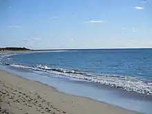
Rockingham Lakes Regional Park is a conservation park approximately 40 kilometres (25 mi) south of Perth, Western Australia, located within the City of Rockingham. The park, established in 1997, covers a non-continuous area of 4,270 hectares (10,600 acres) and occupies approximately 16 percent of the area of the City of Rockingham.
In Western Australia, regional parks consist of areas of land that have been identified as having outstanding conservation, landscape and recreation values. The park contains remnants of the once widespread Swan Coastal Plain and two threatened ecological communities, Thrombolites and Sedgelands. It provides evidence of the sea level changes over the past 7,000 years.
Rockingham Lakes is one of eleven regional parks in the Perth region of Western Australia. The purpose of these regional parks is to serve as urban havens to preserve and restore cultural heritage and valuable ecosystems as well as to encourage sustainable nature-based recreation activities.[1]
History
The concept of regional spaces in Western Australia open to the public was first proposed in 1955, when the Stephenson-Hepburn Report recommended preserving private land for future public use in what would become the Perth Metropolitan Region in 1963. The Environmental Protection Authority, EPA, identified areas of significant conservation, landscape and recreation value, in a report in 1983. In 1989, the Western Australian State Government allocated the responsibility of managing regional parks with the Department of Conservation and Land Management.[2]
A Regional Parks Taskforce was established in 1990 but the EPA reported in 1993 that the establishment of these parks encountered difficulties. In 1997, the state government announced the establishment of the Rockingham Lakes Regional Park.[2]
Areas
Rockingham Lakes Regional Park consists of the following major areas:[2]
| Image | Name | Suburb | Description | Co-ordinates |
|---|---|---|---|---|
 |
Cape Peron | Peron | Rugged limestone cliffs with sandy beaches and offshore reefs[3] | 32°15′55″S 115°41′10″E / 32.265278°S 115.686111°E |
 |
Lake Richmond | Rockingham & Shoalwater | Fresh water lake, 40ha, a maximum of 15 metres deep, home to Australian pelican, black swan, Australian shelduck, musk duck, white-faced heron, common greenshank as well as thrombolites[4] | 32°17′09″S 115°42′51″E / 32.28573°S 115.7143°E |
 |
Lake Cooloongup | Cooloongup | Saline lake, 0.5 to 3.5 metres deep,[5] | 32°17′44″S 115°47′27″E / 32.295556°S 115.790833°E |
 |
Lake Walyungup | Warnbro | Salt lake, 430ha, a maximum of 3.5 metres deep, popular with landsailors[6] | 32°20′26″S 115°46′45″E / 32.340556°S 115.779167°E |
 |
Port Kennedy Scientific Park | Port Kennedy | A Ramsar wetland of international importance, one of the youngest formations on the Swan Coastal Plain[2] | 32°22′16″S 115°43′04″E / 32.370979°S 115.717863°E |
 |
Lark Hill | Port Kennedy | Small area, owned by the Water Corporation[2] | 32°22′36″S 115°45′08″E / 32.376635°S 115.752250°E |
 |
Tamworth Hill | Baldivis | Scenice viewpoint, site of a Water Corporation reservoir[2] | 32°19′06″S 115°48′18″E / 32.3183°S 115.805°E |
 |
Tamworth Hill Swamp | Baldivis | Freshwater wetland[2] | 32°19′45″S 115°48′33″E / 32.329229°S 115.809216°E |
 |
Anstey Swamp | Karnup | Fresh to brackish wetland[2] | 32°24′23″S 115°46′47″E / 32.406361°S 115.779763°E |
 |
Paganoni Swamp | Karnup | Fresh to brackish wetland[2] and upland, home to tuart, jarrah, banksia and sheoak as well as brushtail possums, quenda, brush-tailed phascogales, bobtails, western blue tongues, dugites, heath monitors, black headed monitors, chuditch and Carnaby’s cockatoos[7] | 32°26′25″S 115°46′58″E / 32.440163°S 115.782724°E |
The park covers an area of 4,270 hectares and occupies approximately 16 percent of the area of the City of Rockingham. Most of the park is surrounded by commercial and residential land, only in the south does it border rural areas.[2]
The park is non-continuous, with Cape Peron and Lake Richmond forming an isolated north-western block and Anstey and Paganoni Swamp a separate southern part. The Port Kennedy Scientific Park and Lark Hill block is separated from Lake Cooloongup, Lake Walyungup and Tamworth Hill by a major road- and rail corridor, while smaller roads still separate the other areas.[2]
Unexploded ordnance

The Lake Cooloongup, Lake Walyungup, Port Kennedy Scientific Park and Lark Hill areas are potentially contaminated with unexploded ordnance, having been used as artillery range by the Department of Defence in the era around World War II.[2]
References
- ↑ "National, marine and regional parks in Western Australia" (PDF). Department of Parks and Wildlife. June 2017. Retrieved 28 May 2021.
- 1 2 3 4 5 6 7 8 9 10 11 12 Rockingham Lakes Regional Park Management Plan 2010 (PDF) (Report). Conservation Commission of Western Australia, Department of Environment and Conservation & City of Rockingham. 2010. Retrieved 22 November 2019.
- ↑ "Cape Peron - Rockingham Lakes". Department of Biodiversity, Conservation and Attractions. Retrieved 23 November 2019.
- ↑ "Lake Richmond". Department of Biodiversity, Conservation and Attractions. Retrieved 23 November 2019.
- ↑ "Rockingham Lakes Regional Park". Urban Bushland Council WA Inc. Retrieved 23 November 2019.
- ↑ "Lake Walyungup". Department of Biodiversity, Conservation and Attractions. Retrieved 23 November 2019.
- ↑ "Paganoni Swamp". Department of Biodiversity, Conservation and Attractions. Retrieved 23 November 2019.
External links
- Parks and Wildlife Service: Rockingham Lakes Regional Park
- Urban Bushland Council WA Inc.: Rockingham Lakes Regional Park
- Proposed Port Kennedy and Rockingham Parks Management Framework (1997)