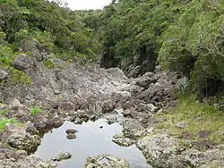
| Rivière des Marsouins | |
|---|---|
 | |
| Location | |
| Country | France |
| Region | Réunion |
| Physical characteristics | |
| Mouth | Indian Ocean |
• coordinates | 21°1′51″S 55°42′57″E / 21.03083°S 55.71583°E |
| Length | 32.3 km (20.1 mi) |
The Rivière des Marsouins is a river on the Indian Ocean island of Réunion. It is 32.3 km (20.1 mi) long.[1] It flows northeast from the center of the island, reaching the sea close to the town of Saint-Benoit. The Rivière des Roches follows a largely parallel course, reaching the sea three kilometres to the north.
References
This article is issued from Wikipedia. The text is licensed under Creative Commons - Attribution - Sharealike. Additional terms may apply for the media files.