Rivière-Bonaventure | |
|---|---|
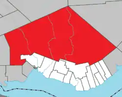 Location within Bonaventure RCM. | |
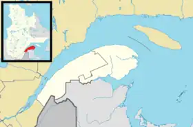 Rivière-Bonaventure Location in eastern Quebec. | |
| Coordinates: 48°30′N 65°36′W / 48.500°N 65.600°W[1] | |
| Country | |
| Province | |
| Region | Gaspésie– Îles-de-la-Madeleine |
| RCM | Bonaventure |
| Constituted | January 1, 1986 |
| Government | |
| • Federal riding | Gaspésie— Îles-de-la-Madeleine |
| • Prov. riding | Bonaventure |
| Area | |
| • Total | 3,052.00 km2 (1,178.38 sq mi) |
| • Land | 3,054.37 km2 (1,179.30 sq mi) |
| There is an apparent contradiction between two authoritative sources | |
| Population (2021)[3] | |
| • Total | 59 |
| • Density | 0.0/km2 (0/sq mi) |
| • Pop 2016-2021 | |
| • Dwellings | 87 |
| Time zone | UTC-5 (EST) |
| • Summer (DST) | UTC-4 (EDT) |
| Highways | |
Rivière-Bonaventure is an unorganized territory in the Gaspésie–Îles-de-la-Madeleine region of Quebec, Canada.
It is named after the 115 kilometres (71 mi) long Bonaventure River that bisects the territory from north to south.[4]
Demographics
Population
|
|
|
Private dwellings occupied by usual residents: 36 (total dwellings: 87)
See also
References
- ↑ "Banque de noms de lieux du Québec: Reference number 149675". toponymie.gouv.qc.ca (in French). Commission de toponymie du Québec.
- 1 2 "Rivière-Bonaventure". Répertoire des municipalités (in French). Ministère des Affaires municipales, des Régions et de l'Occupation du territoire. Retrieved 2011-12-30.
- 1 2 "Rivière-Bonaventure census profile". 2021 Census data. Statistics Canada. Retrieved 2022-03-22.
- ↑ "Rivière Bonaventure" (in French). Commission de toponymie du Québec. Retrieved 2012-01-03.
- ↑ Statistics Canada: 1996, 2001, 2006, 2011, 2016, 2021 census
Adjacent Municipal Subdivisions | ||||||||||||||||
|---|---|---|---|---|---|---|---|---|---|---|---|---|---|---|---|---|
| ||||||||||||||||
| Cities | |
|---|---|
| Municipalities | |
| Parishes | |
| Townships | |
| Unorganized Territories | |
| |
This article is issued from Wikipedia. The text is licensed under Creative Commons - Attribution - Sharealike. Additional terms may apply for the media files.