Radošovice | |
|---|---|
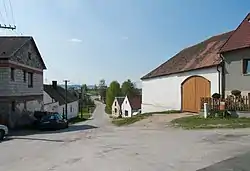 Kapsova Lhota, a part of Radošovice | |
 Radošovice Location in the Czech Republic | |
| Coordinates: 49°14′0″N 13°53′55″E / 49.23333°N 13.89861°E | |
| Country | |
| Region | South Bohemian |
| District | Strakonice |
| First mentioned | 1243 |
| Area | |
| • Total | 10.21 km2 (3.94 sq mi) |
| Elevation | 413 m (1,355 ft) |
| Population (2023-01-01)[1] | |
| • Total | 639 |
| • Density | 63/km2 (160/sq mi) |
| Time zone | UTC+1 (CET) |
| • Summer (DST) | UTC+2 (CEST) |
| Postal code | 386 01 |
| Website | www |
Radošovice is a municipality and village in Strakonice District in the South Bohemian Region of the Czech Republic. It has about 600 inhabitants.
Radošovice lies approximately 4 kilometres (2 mi) south of Strakonice, 51 km (32 mi) north-west of České Budějovice, and 103 km (64 mi) south of Prague.
Administrative parts
Villages and hamlets of Jedraž, Kapsova Lhota, Milíkovice and Svaryšov are administrative parts of Radošovice.
References
Wikimedia Commons has media related to Radošovice (Strakonice District).
This article is issued from Wikipedia. The text is licensed under Creative Commons - Attribution - Sharealike. Additional terms may apply for the media files.