 | ||||
|---|---|---|---|---|
| Bóthar R568 | ||||
 Junction of N71 and R568 at Moll's Gap | ||||
| Route information | ||||
| Length | 22.9 km[1][2] (14.2 mi) | |||
| Major junctions | ||||
| From | ||||
| To | ||||
| Location | ||||
| Country | Ireland | |||
| Highway system | ||||
| ||||
_(28115468516).jpg.webp)
R568 at Dromlusk
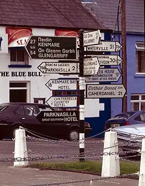
Sneem signpost at junction of N70 and R568
The R568 road is a regional road on the Iveragh Peninsula in County Kerry, Ireland. It travels from the N70 road at Sneem to the N71 at Moll's Gap.[2] The road is 22.9 kilometres (14.2 mi) long.[1][2]
References
- 1 2 Google (15 November 2020). "N70 to N71" (Map). Google Maps. Google. Retrieved 15 November 2020.
- 1 2 3 "S.I. No. 54/2012 – Roads Act 1993 (Classification of Regional Roads) Order 2012". Government of Ireland. 28 February 2012. Retrieved 15 November 2020.
This article is issued from Wikipedia. The text is licensed under Creative Commons - Attribution - Sharealike. Additional terms may apply for the media files.