Route 335 | ||||
|---|---|---|---|---|
 | ||||
 | ||||
| Route information | ||||
| Maintained by Transports Québec | ||||
| Length | 85.5 km[1] (53.1 mi) | |||
| History | ||||
| Major junctions | ||||
| South end | ||||
| North end | ||||
| Location | ||||
| Country | Canada | |||
| Province | Quebec | |||
| Major cities | Montreal, Laval, Terrebonne | |||
| Highway system | ||||
| ||||
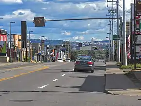
Route 335 is a north-south regional route located on the north shore of the St. Lawrence River. from Montreal It serves the administrative regions of Montreal, Laval, Laurentides, and Lanaudière. It is the only secondary road whose route crosses the Island of Montreal. Between Autoroute 440 in Laval and Côte-Saint-Louis Road in Terrebonne, Route 335 is located in the right-of-way of the future Autoroute 19.
Route description
Route 335 begins in Montreal at Sherbrooke Street (Route 138) and follows Saint Denis Street. North of the Autoroute 40, Route 335 splits to a one-way pair, following Berri Street southbound and Lajeunesse Street northbound, and then crosses the Viau Bridge over Rivière des Prairies to Laval. It follows Laurentian Boulevard to Autoroute 440 on Laurentian Boulevard. Route 335 once followed the entire length of Laurentian Boulevard to the David Bridge on the Rivière des Mille Îles, but now concurrently with Autoroute 440 for about 1.5 km (0.9 mi) to Autoroute 19. Between Autoroute 440 and Dagenais Boulevard, it is co-signed with Autoroute 19, and continues on the Autoroute 19 right-of-way. North of the bridge, the Route 335 once ran along Montée Gagnon from Route 344 northwards, but now follows the Autoroute 19 right-of-way along Louis-Joseph-Papineau Boulevard to Côte-Saint-Louis Road East (French: chemin de la Côte-St-Louis est). North of chemin de la Côte-St-Louis est, Route 335 runs along Montée Gagnon and its historic route.
Formerly Route 65, it was an alternative to Routes 11 and 18.
Future
There are plans to extend Autoroute 19 along Route 335 to Autoroute 640 in Bois-des-Filion with anticipated completion in 2027, with the first phase being 1.5 km (0.9 mi) extension and an interchange at Rue Saint-Saëns. The project includes four new interchanges, reconstruction of the Autoroute 640 interchange, and twinning the Athanase David Bridge.[2][3]
Municipalities along Route 335
Major intersections
| RCM | Location | km[1] | mi | Exit | Destinations | Notes | ||
|---|---|---|---|---|---|---|---|---|
| Montréal | Montréal | 0.0 | 0.0 | Rue Saint Denis | R-335 southern terminus; Rue Saint Denis continues south | |||
| 6.4 | 4.0 | Access via Boulevard Crémazie service roads; A-40 exits 71 (eastbound) and 73 (westbound); one-way transition, northbound follows Rue Lajeunesse, southbound follows Rue Berri | ||||||
| 9.5 | 5.9 | One-way transition | North end of one-way pair; becomes Boulevard des Laurentides | |||||
| Rivière des Prairies | 9.5– 9.9 | 5.9– 6.2 | Pont Viau (Viau Bridge) | |||||
| Laval | 13.3 | 8.3 | Boulevard Saint-Martin | Former R-148 | ||||
| 14.8 | 9.2 | 25 | A-440 exit 25; south end of A-40 concurrency; exit numbers follow A-440 | |||||
| 15.7 | 9.8 | 25 27 | Boulevard René-Laennec | Signed as exits 25 (eastbound) and 27 (westbound) | ||||
| 16.8 | 10.4 | 27 8 | North end of A-440 concurrency; south end of A-19 concurrency; A-440 exit 27; A-19 exit 8 | |||||
| 18.5 | 11.5 | At-grade; A-19 northern terminus; becomes Avenue Papineau; future interchange as part of A-19 extension[2] | ||||||
| 21.9 | 13.6 | Rue Saint-Saëns Est | Future interchange as part of A-19 extension[2] | |||||
| 23.7 | 14.7 | Boulevard des Laurentides / Boulevard des Mille-Îles | Future interchange as part of A-19 extension[2] | |||||
| Rivière des Mille Îles | 24.3– 24.6 | 15.1– 15.3 | Pont Athanase-David (Athanase David Bridge) | |||||
| Thérèse-De Blainville | Bois-des-Filion | 25.1 | 15.6 | Future interchange as part of A-19 extension[2] | ||||
| 26.0 | 16.2 | A-640 exit 28; future A-19 northern terminus[2] | ||||||
| Les Moulins – Thérèse-De Blainville boundary | Terrebonne – Blainville boundary | 31.1 | 19.3 | Montée Gagnon / Chemin de la Côte-Saint-Louis | ||||
| Les Moulins |
No major junctions | |||||||
| Thérèse-De Blainville |
No major junctions | |||||||
| Les Moulins | Terrebonne (La Plaine) | 45.3 | 28.1 | South end of R-337 concurrency | ||||
| Montcalm | Saint-Lin-Laurentides | 52.1 | 32.4 | South end of R-158 concurrency; R-339 northern terminus | ||||
| 53.8 | 33.4 | North end of R-158 concurrency | ||||||
| 57.0 | 35.4 | North end of R-337 concurrency | ||||||
| Saint-Calixte | 74.9 | 46.5 | Chemin du Lac de l'Achigan – Saint-Hippolyte | To R-333 | ||||
| Chertsey – Rawdon boundary | 85.5 | 53.1 | ||||||
1.000 mi = 1.609 km; 1.000 km = 0.621 mi
| ||||||||
See also
- Athanase David Bridge
- List of Quebec provincial highways
- Pont Viau
References
- 1 2 Google (May 24, 2023). "Quebec Route 335" (Map). Google Maps. Google. Retrieved May 24, 2023.
- 1 2 3 4 5 6 "Autoroute 19 entre Laval et Bois-des-Filion – Prolongement". Transports et Mobilité durable Québec (in Canadian French). Gouvernement du Québec. Retrieved May 24, 2023.
- ↑ St-Amour, Stéphane St-Amour (June 30, 2022). "L'autoroute 19 serait complétée à la fin 2027 au coût de 900 M$". Courrier Laval (in Canadian French). Retrieved May 24, 2023.
External links
- Provincial Route Map (Courtesy of the Quebec Ministry of Transportation) (in French)
- Route 335 on Google Maps.

.jpg.webp)