Highway 438 | ||||
|---|---|---|---|---|
| Ruta 438 | ||||
| Route information | ||||
| Maintained by Puerto Rico DTPW | ||||
| Length | 1.7 km[1] (1.1 mi) | |||
| Major junctions | ||||
| West end | ||||
| East end | Barrio Juncal | |||
| Location | ||||
| Country | United States | |||
| Territory | Puerto Rico | |||
| Municipalities | San Sebastián | |||
| Highway system | ||||
| ||||

Puerto Rico Highway 438 (PR-438) is a rural road located entirely in the municipality of San Sebastián, Puerto Rico.[2] With a length of 1.7 kilometers (1.1 mi),[1] it begins at its intersection with PR-111 on the Eneas–Cidral–Magos tripoint, and ends near PR-111 in Juncal barrio.[3]
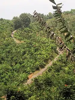 Cuesta de Magos (PR-438) in Magos barrio
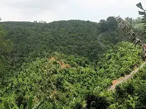 Cuesta de Magos seen from Calabazas barrio
Major intersections
The entire route is located in San Sebastián.
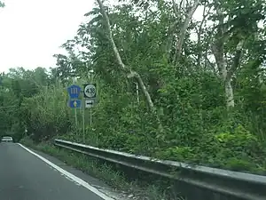 PR-111 east at the western terminus of PR-438
| Location | km[1] | mi | Destinations | Notes | |
|---|---|---|---|---|---|
| Eneas–Cidral– Magos tripoint | 0.0 | 0.0 | Western terminus of PR-438 | ||
| Juncal | 1.7 | 1.1 | Eastern terminus of PR-438 | ||
| 1.000 mi = 1.609 km; 1.000 km = 0.621 mi | |||||
See also
References
- 1 2 3 Google (14 August 2020). "PR-438" (Map). Google Maps. Google. Retrieved 14 August 2020.
- ↑ National Geographic Maps (2011). Puerto Rico (Map). 1:125,000. Adventure Map (Book 3107). Evergreen, Colorado: National Geographic Maps. ISBN 978-1566955188. OCLC 756511572.
- ↑ "Carretera 438, San Sebastián, Puerto Rico". geoview.info. Retrieved 14 August 2020.
External links
 Media related to Puerto Rico Highway 438 at Wikimedia Commons
This article is issued from Wikipedia. The text is licensed under Creative Commons - Attribution - Sharealike. Additional terms may apply for the media files.