Highway 137 | ||||
|---|---|---|---|---|
| Ruta 137 | ||||
| Expreso Ángel A. "Tony" Laureano Martínez[1] | ||||
| Route information | ||||
| Maintained by Puerto Rico DTPW | ||||
| Length | 17.9 km[2] (11.1 mi) | |||
| Major junctions | ||||
| South end | ||||
| ||||
| North end | ||||
| Location | ||||
| Country | United States | |||
| Territory | Puerto Rico | |||
| Municipalities | Morovis, Vega Baja | |||
| Highway system | ||||
| ||||

Puerto Rico Highway 137 (PR-137) is a north–south road that travels from Vega Baja to Morovis.[3] This highway extends from PR-2 in Vega Baja to PR-155 near downtown Morovis[4] and it is known as Expreso Ángel A. "Tony" Laureano Martínez.[1]
 PR-137 with shield in the shape of the island of Puerto Rico
Morovis National Cemetery
Morovis National Cemetery for veterans was established in Morovis in 2020, at a 247.5-acre parcel of land that can be accessed from Highway 137 at km 11.2. It was built to take over the functions of the existing Puerto Rico National Cemetery located in Bayamón.[5][6]
Major intersections
.jpg.webp)
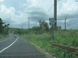
 PR-137 south at PR-22 interchange in Algarrobo, Vega Baja
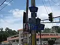 PR-159 east at PR-137 junction in Monte Llano, Morovis
| Municipality | Location | km[2] | mi | Destinations | Notes |
|---|---|---|---|---|---|
| Morovis | Morovis Norte | 17.9 | 11.1 | Southern terminus of PR-137 | |
| Monte Llano | 17.7 | 11.0 | |||
| 17.4 | 10.8 | ||||
| 17.1 | 10.6 | ||||
| Morovis Sud | 15.9 | 9.9 | |||
| Morovis Sud–Morovis Norte line | 15.2 | 9.4 | |||
| Morovis Norte | 12.6 | 7.8 | |||
| Fránquez | 12.0 | 7.5 | |||
| 9.3 | 5.8 | ||||
| 8.7 | 5.4 | Southern terminus of PR-155 concurrency | |||
| Barahona | 8.5 | 5.3 | Northern terminus of PR-155 concurrency | ||
| Vega Baja | Pugnado Adentro | 6.6 | 4.1 | ||
| Pugnado Afuera | 3.1 | 1.9 | |||
| Pugnado Afuera–Algarrobo line | 1.3– 1.2 | 0.81– 0.75 | |||
| Algarrobo | 0.7– 0.2 | 0.43– 0.12 | PR-22 exits 42, 42A and 42B; partial cloverleaf interchange | ||
| 0.0 | 0.0 | Northern terminus of PR-137 | |||
1.000 mi = 1.609 km; 1.000 km = 0.621 mi
| |||||
See also
References
- 1 2 "Ley Núm. 435 del año 2000 Para designar un tramo de la carretera 137 de Morovis, con el nombre de Angel A. Laureano Martínez". LexJuris (Leyes y Jurisprudencia) de Puerto Rico (in Spanish). Retrieved 9 May 2019.
- 1 2 Google (2 March 2020). "PR-137" (Map). Google Maps. Google. Retrieved 2 March 2020.
- ↑ National Geographic Maps (2011). Puerto Rico (Map). 1:125,000. Adventure Map (Book 3107). Evergreen, Colorado: National Geographic Maps. ISBN 978-1566955188. OCLC 756511572.
- ↑ "Tránsito Promedio Diario (AADT)". Puerto Rico Department of Transportation and Public Works (in Spanish). p. 76. Archived from the original on 1 April 2019. Retrieved 9 May 2019.
- ↑ "Puerto Rico National Cemetery Replacement Morovis, Puerto Rico" (PDF). U.S. Dept. of Veterans Affairs. U.S. Dept. of Veterans Affairs.
- ↑ "A claim for better health services". El Nuevo Dia. 28 May 2019. Retrieved 13 June 2019.
External links
 Media related to Puerto Rico Highway 137 at Wikimedia Commons
This article is issued from Wikipedia. The text is licensed under Creative Commons - Attribution - Sharealike. Additional terms may apply for the media files.