Highway 130 | ||||
|---|---|---|---|---|
| Ruta 130 | ||||
| Carretera Estatal Carlos Romero Barceló[1] | ||||
| Route information | ||||
| Maintained by Puerto Rico DTPW | ||||
| Length | 12.1 km[2] (7.5 mi) | |||
| Existed | 1953[3]–present | |||
| Major junctions | ||||
| South end | ||||
| ||||
| North end | ||||
| Location | ||||
| Country | United States | |||
| Territory | Puerto Rico | |||
| Municipalities | Hatillo | |||
| Highway system | ||||
| ||||

Puerto Rico Highway 130 (PR-130) is the main north–south route within the municipality of Hatillo, Puerto Rico.[4]
Route description
The highway starts from the downtown area (from PR-119), crossing the neighborhoods of Capáez, Naranjito, Buena Vista and Campo Alegre until it ends at Carretera Mariana Bracetti (PR-129).[5] In downtown, the highway runs through Calle Luis H. Lacomba and Avenida Pablo J. Aguilar until it crosses PR-2 in a southerly direction. This route is part of the caravan of the Hatillo Mask Festival.
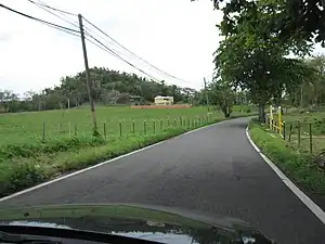 Puerto Rico highway 130 heading north
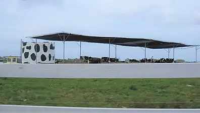 One of many dairy farms located along PR-130
Major intersections
The entire route is located in Hatillo.
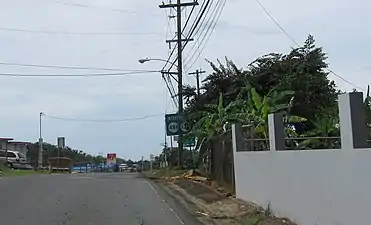 PR-488 and PR-130 junction in Hatillo
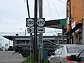 PR-130 north at PR-492 intersection
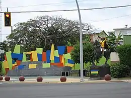 "Hatillo Mask Festival" statue located at downtown entrance
| Location | km[2] | mi | Destinations | Notes | |
|---|---|---|---|---|---|
| Campo Alegre | 12.1 | 7.5 | Southern terminus of PR-130 | ||
| Buena Vista–Naranjito– Campo Alegre–Corcovado quadripoint | 8.7 | 5.4 | |||
| Buena Vista–Naranjito line | 8.0 | 5.0 | |||
| Naranjito | 6.2 | 3.9 | |||
| Naranjito–Capáez line | 5.0 | 3.1 | |||
| Hatillo barrio-pueblo | 0.5 | 0.31 | |||
| 0.0 | 0.0 | Northern terminus of PR-130 | |||
| 1.000 mi = 1.609 km; 1.000 km = 0.621 mi | |||||
See also
References
- ↑ "Pueden pasarle por encima a Romero Barceló - NOTICEL". NotiCel - La verdad como es - Noticias de Puerto Rico - NOTICEL (in Spanish). Retrieved 10 April 2019.
- 1 2 Google (2 March 2020). "PR-130" (Map). Google Maps. Google. Retrieved 2 March 2020.
- ↑ "Hatillo, Memoria Núm. 63" (PDF). Puerto Rico Planning Board (in Spanish). 1954. Retrieved 4 August 2020.
- ↑ National Geographic Maps (2011). Puerto Rico (Map). 1:125,000. Adventure Map (Book 3107). Evergreen, Colorado: National Geographic Maps. ISBN 978-1566955188. OCLC 756511572.
- ↑ Puerto Rico Department of Transportation and Public Works. "Datos de Transito 2000-2009" (in Spanish). Archived from the original on 1 April 2019. Retrieved 24 March 2019.
External links
 Media related to Puerto Rico Highway 130 at Wikimedia Commons
This article is issued from Wikipedia. The text is licensed under Creative Commons - Attribution - Sharealike. Additional terms may apply for the media files.