Plataies
Πλαταιές | |
|---|---|
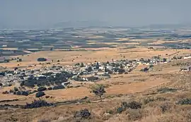
 City of Plataies, near the ruins of old Plataea. Location of the 479 BCE Battle of Plataea. | |
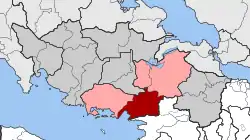
 Plataies Location within the regional unit  | |
| Coordinates: 38°14′N 23°13′E / 38.233°N 23.217°E | |
| Country | Greece |
| Administrative region | Central Greece |
| Regional unit | Boeotia |
| Municipality | Thebes |
| • Municipal unit | 172.533 km2 (66.615 sq mi) |
| Population (2021) | |
| • Municipal unit | 3,602 |
| • Municipal unit density | 21/km2 (54/sq mi) |
| Community | |
| • Population | 832 (2021) |
| • Area (km2) | 37.321 |
| Time zone | UTC+2 (EET) |
| • Summer (DST) | UTC+3 (EEST) |
| Vehicle registration | ΒΙ |
Plataies (Greek: Πλαταιές), anciently Kokhla,[1][2][3] is a village and a former municipality in Boeotia, Greece. Since the 2011 local government reform it is part of the municipality Thebes, of which it is a municipal unit.[4] The municipal unit has an area of 172.533 km2, the community 37.321 km2.[5] Population 4,908 (2011). The seat of the former municipality was in Kaparelli.

View of Plataies and surrounding area from above.

Ruins of Plataea.
The village is next to the ruins of the ancient city of Plataea and near the site of the Battle of Plataea.
See also
References
- ↑ Perdicaris, G. A. (1846). The Greece of the Greeks. Paine & Burgess. p. 127.
- ↑ 19th century map
- ↑ Smith, James Reuel (1922). Springs and wells in Greek and Roman literature, their legends and locations. New York, G. P. Putnam's sons. p. 198.
- ↑ "ΦΕΚ B 1292/2010, Kallikratis reform municipalities" (in Greek). Government Gazette.
- ↑ "Population & housing census 2001 (incl. area and average elevation)" (PDF) (in Greek). National Statistical Service of Greece.
This article is issued from Wikipedia. The text is licensed under Creative Commons - Attribution - Sharealike. Additional terms may apply for the media files.