Pertteli
Pertteli – S:t Bertils | |
|---|---|
| Perttelin kunta S:t Bertils kommun | |
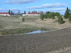 Haali Manor in Pertteli. | |
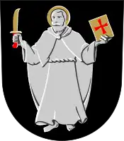 Coat of arms | |
 | |
| Country | Finland |
| Province | Western Finland |
| Region | Southwest Finland |
| Sub-region | Salo |
| Merged with Salo | January 1, 2009 |
| Seat | Inkere |
| Government | |
| • City manager | Ilkka Salminen |
| Area | |
| • Total | 156.08 km2 (60.26 sq mi) |
| • Land | 154.15 km2 (59.52 sq mi) |
| • Water | 1.93 km2 (0.75 sq mi) |
| • Rank | 356th |
| Population (2003) | |
| • Total | 3,773 |
| • Rank | 248th |
| • Density | 24/km2 (63/sq mi) |
| +1.6 % change | |
| Time zone | UTC+2 (EET) |
| • Summer (DST) | UTC+3 (EEST) |
| Official languages | Finnish |
| Urbanisation | 59.5% |
| Unemployment rate | 8.3% |
| Website | http://www.pertteli.fi/ |
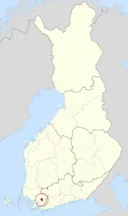
Pertteli (Finnish pronunciation: [ˈpertːeli]); Swedish: S:t Bertils) is a former municipality of Finland. It was consolidated with Salo on January 1, 2009.
It is located in the province of Western Finland and is part of the Southwest Finland region. The municipality had a population of 3,833 (2004-12-31) and covered an area of 156.08 km² of which 1.93 km² is water. The population density was 24.87 inhabitants per km². Inkere was the administrative center of Pertteli.
The municipality was unilingually Finnish.
Saint Bartholomew is the namesake of the municipality and is the subject of the heraldic shield.
External links
![]() Media related to Pertteli at Wikimedia Commons
Media related to Pertteli at Wikimedia Commons
![]() Pertteli travel guide from Wikivoyage
Pertteli travel guide from Wikivoyage
- http://www.pertteli.fi/ – Official website (in Finnish)
| Municipalities |  | |
|---|---|---|
| Former municipalities |
| |
60°26′50″N 23°14′55″E / 60.44722°N 23.24861°E
This article is issued from Wikipedia. The text is licensed under Creative Commons - Attribution - Sharealike. Additional terms may apply for the media files.