Otis, Colorado | |
|---|---|
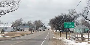
 Entering Otis from the east. | |
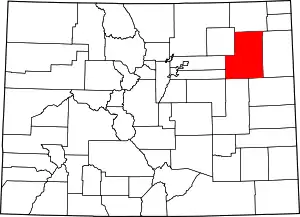
 Location of Otis in Washington County, Colorado. | |
| Coordinates: 40°9′2″N 102°57′45″W / 40.15056°N 102.96250°W | |
| Country | |
| State | |
| County[1] | Washington |
| Incorporated (town) | March 27, 1917[2] |
| Government | |
| • Type | Statutory Town[1] |
| • Mayor | Jennifer Brandon |
| • Mayor Pro Tem | Brooke Price |
| Area | |
| • Total | 0.41 sq mi (1.07 km2) |
| • Land | 0.41 sq mi (1.07 km2) |
| • Water | 0.00 sq mi (0.00 km2) |
| Elevation | 4,360 ft (1,329 m) |
| Population | |
| • Total | 511 |
| • Density | 1,200/sq mi (480/km2) |
| Time zone | UTC-7 (Mountain (MST)) |
| • Summer (DST) | UTC-6 (MDT) |
| ZIP code[6] | 80743 |
| Area code | 970 |
| FIPS code | 08-56365 |
| GNIS feature ID | 0182989 |
| Website | townofotis |
Otis is a Statutory Town in Washington County, Colorado, United States. The population was 511 at the 2020 census.[5]
History
Otis was established in 1882 as a construction campsite for workers building the Burlington & Missouri River rail line from Lincoln Nebraska to Denver, Colorado.[7] According to tradition, the community was named after W. O. Otis, a pioneer settler.[8] The post office opened in 1886 and the town was platted in 1887.[9]
Geography
Otis is located at 40°9′2″N 102°57′45″W / 40.15056°N 102.96250°W (40.150645, -102.962521).[10]
According to the United States Census Bureau, the town has a total area of 0.4 square miles (1.0 km2), all of it land.
Demographics
| Census | Pop. | Note | %± |
|---|---|---|---|
| 1920 | 467 | — | |
| 1930 | 529 | 13.3% | |
| 1940 | 498 | −5.9% | |
| 1950 | 532 | 6.8% | |
| 1960 | 568 | 6.8% | |
| 1970 | 521 | −8.3% | |
| 1980 | 534 | 2.5% | |
| 1990 | 451 | −15.5% | |
| 2000 | 534 | 18.4% | |
| 2010 | 475 | −11.0% | |
| 2020 | 511 | 7.6% |
Climate
According to the Köppen Climate Classification system, Otis has a semi-arid climate, abbreviated "BSk" on climate maps.[11]
| Climate data for Otis, Colorado | |||||||||||||
|---|---|---|---|---|---|---|---|---|---|---|---|---|---|
| Month | Jan | Feb | Mar | Apr | May | Jun | Jul | Aug | Sep | Oct | Nov | Dec | Year |
| Mean daily maximum °C (°F) | 4 (39) |
7 (44) |
11 (51) |
16 (60) |
21 (70) |
28 (82) |
32 (90) |
30 (86) |
26 (78) |
18 (65) |
10 (50) |
4 (40) |
17 (63) |
| Mean daily minimum °C (°F) | −11 (13) |
−8 (17) |
−4 (24) |
0 (32) |
6 (42) |
11 (52) |
14 (58) |
13 (56) |
8 (47) |
2 (35) |
−5 (23) |
−10 (14) |
1 (34) |
| Average precipitation mm (inches) | 7.6 (0.3) |
10 (0.4) |
25 (1) |
43 (1.7) |
71 (2.8) |
58 (2.3) |
66 (2.6) |
58 (2.3) |
30 (1.2) |
23 (0.9) |
15 (0.6) |
10 (0.4) |
420 (16.6) |
| Source: Weatherbase[12] | |||||||||||||
See also
References
- 1 2 "Active Colorado Municipalities". State of Colorado, Department of Local Affairs. Archived from the original on December 12, 2009. Retrieved September 1, 2007.
- ↑ "Colorado Municipal Incorporations". State of Colorado, Department of Personnel & Administration, Colorado State Archives. December 1, 2004. Retrieved September 2, 2007.
- ↑ "2019 U.S. Gazetteer Files". United States Census Bureau. Retrieved July 1, 2020.
- ↑ "US Board on Geographic Names". United States Geological Survey. October 25, 2007. Retrieved January 31, 2008.
- 1 2 United States Census Bureau. "Otis town, Colorado". Retrieved April 19, 2023.
- ↑ "ZIP Code Lookup". United States Postal Service. Archived from the original (JavaScript/HTML) on November 4, 2010. Retrieved November 28, 2007.
- ↑ BNSF Track Segments, Version 9, compiled by Alan Eisenberg, Revised 10 Nov 2005.
- ↑ Dawson, John Frank. Place names in Colorado: why 700 communities were so named, 150 of Spanish or Indian origin. Denver, CO: The J. Frank Dawson Publishing Co. p. 38.
- ↑ Zion, Lee. "Map and Place Name Directory". Washington County Colorado. Retrieved March 15, 2011.
- ↑ "US Gazetteer files: 2010, 2000, and 1990". United States Census Bureau. February 12, 2011. Retrieved April 23, 2011.
- ↑ Climate Summary for Otis, Colorado
- ↑ "Weatherbase.com". Weatherbase. 2013. Retrieved on October 2, 2013.
