Ohio Township | |
|---|---|
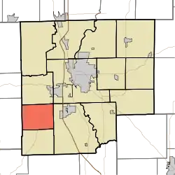 Location in Bartholomew County | |
| Coordinates: 39°07′31″N 86°01′40″W / 39.12528°N 86.02778°W | |
| Country | United States |
| State | Indiana |
| County | Bartholomew |
| Government | |
| • Type | Indiana township |
| Area | |
| • Total | 20.26 sq mi (52.5 km2) |
| • Land | 19.75 sq mi (51.2 km2) |
| • Water | 0.51 sq mi (1.3 km2) 2.52% |
| Elevation | 676 ft (206 m) |
| Population (2010) | |
| • Total | 1,787 |
| • Density | 90.5/sq mi (34.9/km2) |
| ZIP code | 47201 |
| GNIS feature ID | 0453682 |
Ohio Township is one of twelve townships in Bartholomew County, Indiana, United States. As of the 2010 census, its population was 1,787 and it contained 782 housing units.[1]
Geography
According to the 2010 census, the township has a total area of 20.26 square miles (52.5 km2), of which 19.75 square miles (51.2 km2) (or 97.48%) is land and 0.51 square miles (1.3 km2) (or 2.52%) is water.[1]
Unincorporated towns
(This list is based on USGS data and may include former settlements.)
Adjacent townships
- Harrison Township (north)
- Columbus Township (northeast)
- Wayne Township (east)
- Jackson Township (south)
- Van Buren Township, Brown County (west)
Cemeteries
The township contains these two cemeteries: Roth and Saint Paul.
Lakes
- Noblitt Lake
School districts
- Bartholomew County School Corporation
Political districts
- Indiana's 9th congressional district
- State House District 65
- State Senate District 41
References
- United States Census Bureau 2007 TIGER/Line Shapefiles
- United States Board on Geographic Names (GNIS)
- United States National Atlas
- 1 2 "Population, Housing Units, Area, and Density: 2010 - County -- County Subdivision and Place -- 2010 Census Summary File 1". United States Census. Archived from the original on February 12, 2020. Retrieved May 10, 2013.
External links
Wikimedia Commons has media related to Ohio Township, Bartholomew County, Indiana.
Municipalities and communities of Bartholomew County, Indiana, United States | ||
|---|---|---|
| City | Map of Indiana highlighting Bartholomew County | |
| Towns | ||
| Townships | ||
| CDPs | ||
| Other communities | ||
| Ghost town | ||
| Footnotes | ‡This populated place also has portions in an adjacent county or counties | |
This article is issued from Wikipedia. The text is licensed under Creative Commons - Attribution - Sharealike. Additional terms may apply for the media files.