State Route 45 | ||||
|---|---|---|---|---|
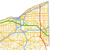 Route of SR 45 highlighted in red | ||||
| Route information | ||||
| Maintained by ODOT | ||||
| Length | 96.56 mi[1] (155.40 km) | |||
| Existed | 1924–present | |||
| Major junctions | ||||
| South end | ||||
| North end | ||||
| Location | ||||
| Country | United States | |||
| State | Ohio | |||
| Counties | Columbiana, Mahoning, Trumbull, Ashtabula | |||
| Highway system | ||||
| ||||
| ||||

State Route 45 (SR 45) is a north–south state highway in the northeastern portion of the U.S. state of Ohio. Its southern terminus is at the State Route 7/State Route 39 concurrency in Wellsville, and its northern terminus is at State Route 531 about three miles (4.8 km) west of Ashtabula.
History

SR 45 northbound in Bristolville

Route 45 in Rock Creek, Ashtabula
- 1924 – Original route established;[2] originally routed from Lisbon to Geneva along its current route from Lisbon to 1½ miles south of Salem, from 1½ miles south of Salem to 1½ miles north of Salem on a currently unnumbered road, along its current route from 1½ miles north of Salem to North Bloomfield, from North Bloomfield to Windsor on a currently unnumbered road, and from Windsor to Geneva along current State Route 534.[3]
- 1931 – By this time, rerouted from North Bloomfield to Orwell along a previously unnumbered road, and from Orwell to Windsor along U.S. Route 322; original routing from North Bloomfield to Windsor decertified.[3]
- 1932 – Extended to Wellsville along the former alignment of State Route 153 from Wellsville to West Point, and along U.S. Route 30 (formerly State Route 5 before 1926) from West Point to Lisbon.[3]
- 1938 – Rerouted north from Orwell to its current northern terminus; former alignment from Windsor to Geneva certified as State Route 534.[3]
- 1976 – Routed around Salem on newly completed bypass (southwest portion completed in 1972; bypass certified as State Route 45B in 1974).[3]
- 1997 – From Lisbon to State Route 558 upgraded to divided highway.[3]
Major intersections
| County | Location | mi[1] | km | Destinations | Notes |
|---|---|---|---|---|---|
| Columbiana | Wellsville | 0.00– 0.47 | 0.00– 0.76 | Interchange | |
| Madison Township | 8.95 | 14.40 | Southern end of US 30 concurrency | ||
| 9.78 | 15.74 | Eastern terminus of SR 518 | |||
| Lisbon | 14.80 | 23.82 | Southern end of SR 154 concurrency | ||
| 15.34 | 24.69 | Northern end of US 30 concurrency; western terminus of SR 154, northern end of SR 154 concurrency; southern end of SR 164 concurrency; western terminus of SR 517, southern end of SR 517 concurrency | |||
| 15.69 | 25.25 | Northern end of SR 164 concurrency; western terminus of SR 517 | |||
| Salem Township | 20.73 | 33.36 | Western terminus of SR 558 | ||
| Perry Township | 25.68 | 41.33 | |||
| 26.91 | 43.31 | Southern end of US 62 concurrency | |||
| 27.32 | 43.97 | ||||
| 28.79– 29.09 | 46.33– 46.82 | Interchange; eastern terminus of SR 14T | |||
| 29.34 | 47.22 | Northern end of US 62 concurrency | |||
| Mahoning | Goshen–Green township line | 30.60 | 49.25 | ||
| Ellsworth Township | 36.15 | 58.18 | |||
| Trumbull | Warren | 51.08 | 82.21 | ||
| Champion Township | 54.24– 54.40 | 87.29– 87.55 | Interchange | ||
| 56.66 | 91.19 | ||||
| Bristol Township | 62.27 | 100.21 | |||
| Bloomfield Township | 67.41 | 108.49 | |||
| Ashtabula | Orwell | 72.47 | 116.63 | ||
| Rome Township | 77.32 | 124.43 | |||
| Austinburg Township | 88.99 | 143.22 | |||
| 89.96– 90.08 | 144.78– 144.97 | Exit 223 (I-90) | |||
| Saybrook Township | 92.39 | 148.69 | |||
| 93.42 | 150.34 | ||||
| 96.56 | 155.40 | ||||
1.000 mi = 1.609 km; 1.000 km = 0.621 mi
| |||||
References
- 1 2 "DESTAPE". Ohio Department of Transportation. November 2, 2020. Retrieved May 18, 2021.
- ↑ Explanation of the Ohio State Highway System (The Unofficial Ohio State Highways Web Site) by John Simpson Archived May 23, 2006, at the Wayback Machine
- 1 2 3 4 5 6 Route 45 (The Unofficial Ohio State Highways Web Site) by John Simpson Archived December 21, 2004, at the Wayback Machine
External links
Template:Attached KML/Ohio State Route 45
KML is from Wikidata
 Media related to Ohio State Route 45 at Wikimedia Commons
This article is issued from Wikipedia. The text is licensed under Creative Commons - Attribution - Sharealike. Additional terms may apply for the media files.