Nushki District
ضلع نوشکی نوشکے دمگ | |
|---|---|
  Top: Camels in Nushki Desert Bottom: Rako rock formation near Nushki | |
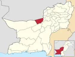 Map of Balochistan with Nushki District higlighted | |
| Country | Pakistan |
| Province | Balochistan |
| Division | Rakhshan |
| Headquarters | Nushki |
| Government | |
| • Type | District Administration |
| • Deputy Commissioner | N/A |
| • District Police Officer | N/A |
| • District Health Officer | N/A |
| Area | |
| • Total | 5,797 km2 (2,238 sq mi) |
| Population (2017)[1] | |
| • Total | 178,947 |
| • Density | 31/km2 (80/sq mi) |
| Time zone | UTC+5 (PST) |
| Number of Tehsils | 1 |
Nushki District (Urdu: ضلع نوشکی, locally known as Noshkay نوشکے) is one of the districts of Balochistan province, Pakistan. The administration of the Nushki district was taken over from the Khan of Kalat by the British government in 1896, and was leased from him on a perpetual quit rent in 1899.
Etymology
Nushki drew from two Balochi words "Nosh-Koh" which stands for finishing work,the area was known as "Noshkay" until it was changed to "Noshki" during british era.
Demographics
At the time of the 2017 census the district had 22,333 households and a population of 178,947. Nushki had a sex ratio of 933 females per 1000 males and a literacy rate of 51.67% - 63.99% for males and 38.45% for females. 46,396 (25.93%) lived in urban areas. 32.68% of the population was under 10 years of age. Islam was the predominant religion with 99.36% while Hindus were 0.56% of the population.[1]
At the time of the 2017 census, 60.13% of the population spoke Brahui, 32.41% Balochi and 6.23% Pashto as their first language.[1]
The following tribes are found in the district:
- Mandai
- Badini
- Jalamdini
- Mohammad Hassani
- Sarparah
- Syed
- Barech
- Mengal
- Pirkani
- Sasoli
- Sumalani
- Rodeni
- Yallanzai
- Hassanzai
Administrative divisions
Nushki District has only one teshil: Nushki Tehsil; which is further sub-divided into eight union councils: Mengal, Badini Kashingi, Anam Bostan, Dak, Jamaldini, Ahmedwal, Mal, M/C Noshki
References
- 1 2 3 "District Wise Results / Tables (Census - 2017)". www.pbscensus.gov.pk. Pakistan Bureau of Statistics.
Bibliography
- District Gazetteer 1905
- 1998 District census report of Chagai. Census publication. Vol. 38. Islamabad: Population Census Organization, Statistics Division, Government of Pakistan. 1999.
External links
Provincial capital: Quetta | ||
| Kalat |  | |
| Makran | ||
| Nasirabad | ||
| Quetta | ||
| Sibi | ||
| Zhob | ||
| Rakhshan | ||
| Loralai | ||
a - formerly part of Quetta Division; b - formerly part of Kalat Division; c - formerly part of Zhob Division | ||
29°30′N 65°40′E / 29.500°N 65.667°E