Trunk 3 | ||||
|---|---|---|---|---|
| Lighthouse Route | ||||
| Route information | ||||
| Maintained by Nova Scotia Department of Transportation and Infrastructure Renewal | ||||
| Length | 389.4 km[1] (242.0 mi) | |||
| Major junctions | ||||
| East end | Connaught Avenue in Halifax | |||
| West end | ||||
| Location | ||||
| Country | Canada | |||
| Province | Nova Scotia | |||
| Counties | Halifax, Lunenburg, Queens, Shelburne, Yarmouth Halifax Regional Municipality, Chester Municipal District, Lunenburg Municipal District, Region of Queens Municipality, Municipality of the District of Shelburne Municipality of the District of Barrington Municipality of the District of Yarmouth, Municipality of Argyle | |||
| Towns | Yarmouth, Shelburne, Lockeport, Bridgewater, Lunenburg, Mahone Bay | |||
| Highway system | ||||
| ||||

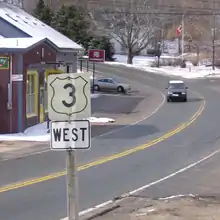
Nova Scotia Trunk 3 is an east-west trunk highway in Nova Scotia. The route runs from Halifax to Yarmouth, along the South Shore. Trunk 3's status as an important regional highway link has been superseded by the parallel Highway 103.
Route description
The eastern terminus of Trunk 3 on provincial maps is at the Armdale Roundabout in Halifax.[2] Travelling inbound from the traffic circle along Quinpool Road, Trunk 3 continues to be marked with "3 INBOUND" signs until just before Quinpool Road's intersection with Connaught Avenue. The sign "3 ENDS" marks the signed eastern terminus of the route. Traveling outbound from the traffic circle Trunk 3 formally proceeds west using the name St. Margaret's Bay Road and passes through Timberlea and Upper Tantallon.
The road follows the coast of St. Margarets Bay, passing through Hubbards. It crosses the isthmus of the Aspotogan Peninsula to reach Chester. West of Chester, Trunk 3 follows the shore of Mahone Bay to reach the town of the same name. The highway then turns southeast to the town of Lunenburg, enters the town following Maple Street, Falkland Street and Victoria Road, before continuing westward to the town of Bridgewater.[2]
Leaving Bridgewater to the southwest, Trunk 3 intersects Highway 103 at exit 14. Trunk 3 is no longer signed in some portions between Bridgewater and Barrington, as Highway 103 assumed some of its former route in the 1970s. Trunk 3 "re-appears" as the main street and approaches to some towns that Highway 103 has bypassed, including the Liverpool, Lockeport and Shelburne areas.[2]
At Barrington, Trunk 3 departs Highway 103. The highway closely follows the coast of the Barrington Passage and the Gulf of Maine to reach the Pubnico area, then continuing north along the coast to Argyle. The highway turns west through Tusket to reach its western end at Yarmouth where it meets the Highway 101 and Trunk 1.[2]
Communities
Major intersections
| County | Location | km[1] | mi | Destinations | Notes | ||
|---|---|---|---|---|---|---|---|
| Halifax | Halifax | −1.4 | −0.87 | Signed as Trunk 3 Inbound/Outbound along Quinpool Road | |||
| 0.0 | 0.0 | Chebucto Road – Macdonald Bridge Herring Cove Road (Route 349 south) to Purcells Cove Road (Route 253) | Armdale Rotary Trunk 3 eastern terminus; Trunk 3 follows St. Margarets Bay Road | ||||
| 1.9 | 1.2 | Partially grade separated; formerly Northwest Arm Drive | |||||
| 3.6 | 2.2 | ||||||
| Timberlea | 4.0 | 2.5 | Hwy 103 exit 2 | ||||
| Hubley | 5.6 | 3.5 | Hwy 103 exit 4 | ||||
| Upper Tantallon | 24.0 | 14.9 | |||||
| 24.3 | 15.1 | ||||||
| Lunenburg | Hubbards | 47.2 | 29.3 | ||||
| East River | 57.1 | 35.5 | Route 329 is signed as north but heads south[3] | ||||
| Chester | 68.5 | 42.6 | |||||
| Chester Basin | 73.5 | 45.7 | |||||
| Mahone Bay | 90.4 | 56.2 | |||||
| Lunenburg | 99.9 | 62.1 | East end of Route 332 concurrency | ||||
| 100.1 | 62.2 | West end of Route 332 concurrency | |||||
| 101.7 | 63.2 | ||||||
| 103.6 | 64.4 | ||||||
| Upper LaHave | 113.6 | 70.6 | |||||
| Bridgewater | 119.6 | 74.3 | Trunk 3 turns onto Old Bridge Street | ||||
| 119.8 | 74.4 | Crosses the LaHave River | |||||
| 119.9 | 74.5 | Trunk 3 turns onto King Street; east end of Route 331 concurrency | |||||
| 120.1 | 74.6 | Trunk 3 turns onto Dufferin Street; west end of Route 331 concurrency | |||||
| Hebb's Cross | 128.1 | 79.6 | At-grade; Hwy 103 exit 14 | ||||
| Gap in Trunk 3 | |||||||
| Queens | | 157.1 | 97.6 | At-grade; Hwy 103 exit 18 | |||
| Liverpool | 164.4 | 102.2 | |||||
| 165.2 | 102.7 | Crosses the Mersey River | |||||
| | 184.2 | 114.5 | Connects to Hwy 103 exit 21 | ||||
| Port Mouton | 186.0 | 115.6 | Central Port Mouton Road – South West Port Mouton | ||||
| | 186.7 | 116.0 | Hwy 103 | Intersection closed (dead end), use exit 21[4] | |||
| Gap in Trunk 3 | |||||||
| Queens | | 191.5 | 119.0 | At-grade; Hwy 103 exit 22; east end of Trunk 3 unsigned section | |||
| Port Joli | 193.5 | 120.2 | St. Catherines Road – Kejimkujik National Park (Seaside Adjunct) | ||||
| | 196.0 | 121.8 | Hwy 103 | Intersection closed (dead end), use exit 22;[4] west end of Trunk 3 unsigned section | |||
| Gap in Trunk 3 | |||||||
| Shelburne | Sable River | 209.3 | 130.1 | At-grade; Hwy 103 exit 23 | |||
| Jordan Falls | 242.8 | 150.9 | At-grade; Hwy 103 exit 24 | ||||
| Gap in Trunk 3 | |||||||
| Shelburne | | 248.5 | 154.4 | At-grade; Hwy 103 exit 25 | |||
| Shelburne | 255.1 | 158.5 | |||||
| Birchtown | 262.1 | 162.9 | At-grade; Hwy 103 exit 27 | ||||
| Gap in Trunk 3 | |||||||
| Shelburne | Barrington | 298.7 | 185.6 | At-grade; Hwy 103 exit 29 | |||
| 300.0 | 186.4 | Route 309 is signed as north but heads south[5] | |||||
| Barrington Passage | 308.0 | 191.4 | |||||
| Yarmouth | Pubnico | 347.6 | 216.0 | ||||
| Argyle | 361.4 | 224.6 | At-grade; east end of Hwy 103 unsigned concurrency; Hwy 103 exit 32 | ||||
| 362.0 | 224.9 | Crosses the Argyle River | |||||
| 362.4 | 225.2 | At-grade; west end of Hwy 103 unsigned concurrency; Hwy 103 exit 32A | |||||
| Tusket | 374.1 | 232.5 | East end of Route 308 concurrency | ||||
| 374.6 | 232.8 | West end of Route 308 concurrency | |||||
| 376.0 | 233.6 | Crosses the Tusket River | |||||
| Yarmouth | 387.3 | 240.7 | |||||
| 387.9 | 241.0 | Hwy 101 western terminus | |||||
| 389.4 | 242.0 | Trunk 3 western terminus | |||||
1.000 mi = 1.609 km; 1.000 km = 0.621 mi
| |||||||
References
- 1 2 Google (February 24, 2020). "Nova Scotia Trunk 3" (Map). Google Maps. Google. Retrieved February 24, 2020.
- 1 2 3 4 Nova Scotia Road Map (Map). 1:640,000. Province of Nova Scotia. 2019. §§ K-5, L-5, L-6, M-5, N-1, N-2, N-4, O-2, O-3, P-2, P-3.
- ↑ Google (2018). "Route 329 - East River, NS". Google Streetview. Retrieved February 24, 2020.
{{cite web}}:|last1=has generic name (help) - 1 2 "Highway 103: Broad River to Port Joli Phase 1" (PDF). Nova Scotia Transportation & Infrastructure Renewal. Government of Nova Scotia. January 2014. Retrieved August 20, 2019.
- ↑ Google (2018). "Route 309 - Barrington, NS". Google Streetview. Retrieved February 24, 2020.
{{cite web}}:|last1=has generic name (help)