Notre-Dame-des-Bois | |
|---|---|
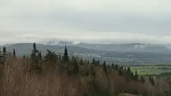 Notre-Dame-des-Bois, Québec (Canada). View from the road to the summit of Mont-Mégantic. | |
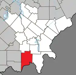 Location within Le Granit RCM | |
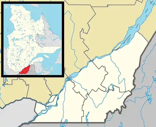 Notre-Dame-des-Bois Location in southern Quebec | |
| Coordinates: 45°24′N 71°04′W / 45.4°N 71.07°W[1] | |
| Country | |
| Province | |
| Region | Estrie |
| RCM | Le Granit |
| Constituted | January 1, 1877 |
| Government | |
| • Mayor | Jean-Louis Gobeil |
| • Federal riding | Mégantic—L'Érable |
| • Prov. riding | Mégantic |
| Area | |
| • Total | 192.10 km2 (74.17 sq mi) |
| • Land | 192.51 km2 (74.33 sq mi) |
| There is an apparent contradiction between to authoritative sources | |
| Population | |
| • Total | 1,028 |
| • Density | 5.3/km2 (14/sq mi) |
| • Pop 2016-2021 | |
| • Dwellings | 817 |
| Time zone | UTC−5 (EST) |
| • Summer (DST) | UTC−4 (EDT) |
| Postal code(s) | |
| Area code | 819 |
| Highways | |
| Website | www |
Notre-Dame-des-Bois is a municipality in Le Granit Regional County Municipality in the Estrie region of Quebec, Canada, on the Canada–United States border. The population was 1,028 as of the Canada 2021 Census.
Located in the Appalachians, it lies at 555 metres in altitude, making it one of the highest towns in Quebec. Mont-Mégantic National Park is located in Notre-Dame-des-Bois and is one of the biggest tourism draws to the region.
Sources
- ↑ "Banque de noms de lieux du Québec: Reference number 44865". toponymie.gouv.qc.ca (in French). Commission de toponymie du Québec.
- 1 2 "Répertoire des municipalités: Geographic code 30010". www.mamh.gouv.qc.ca (in French). Ministère des Affaires municipales et de l'Habitation.
- 1 2 "Data table, Census Profile, 2021 Census of Population - Notre-Dame-des-Bois, Municipalité (MÉ) [Census subdivision], Quebec". 9 February 2022.
External links
 Media related to Notre-Dame-des-Bois at Wikimedia Commons
Places adjacent to Notre-Dame-des-Bois | |
|---|---|
| Cities | |
|---|---|
| Municipalities | |
| Parishes | |
| Townships | |
| |
This article is issued from Wikipedia. The text is licensed under Creative Commons - Attribution - Sharealike. Additional terms may apply for the media files.